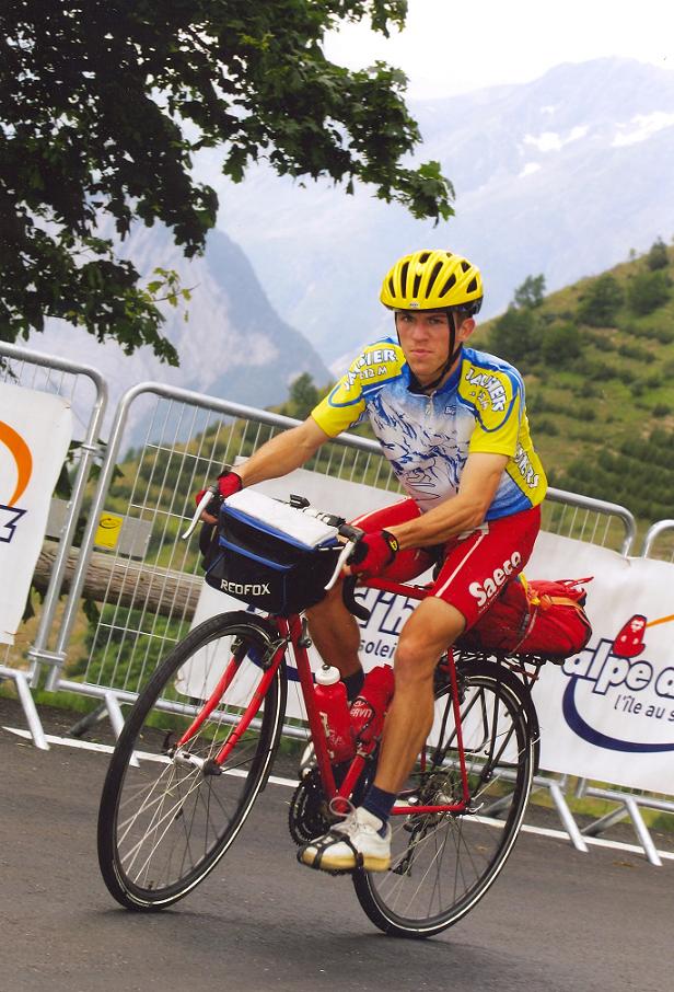
Bicycle tour in Andalucia - www.facebook.com/cycling.high Bicycling in Andalucia: Pico Veleta (3394 m), Puerto Ragua, Sierra Nevada, Granada, Costa del Col, etc. <br>
Györgyi Gábor - facebook.com/cycling.high
Cycling pages of GÁBOR GYÖRGYI - www.facebook.com/cycling.high
Bicycling in Andalucia: Pico Veleta (3394 m), Puerto Ragua, Sierra Nevada, Granada, Costa del Col, etc.
In the year 2004 I had my first serious bicycle tour in the Alps. In the following 7-8 years I cycled all of the paved cols, summits, peaks above 2000 m in the Alps, Pyrénées and Canary islands that can be reached on a paved road so in the year 2012 I felt motivation to visit Andalucia and cycle up to the highest point of Europe that can be reached on a paved road: Pico Veleta (3394 m).
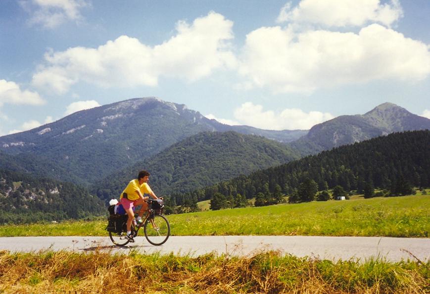
The asphalt ends at ca. 3300 m. A bicycle touring partner joined my but he could get ticket for an airplane only 2-3 days after my flight.
10th Aug, 2012.: Malaga – Gibralfaro - Puerto del Leon felé (to 530 m) – Malaga – Benajarafe, Vale Niza camping = 109,52 km + 1053 m
After several years the arriving at known airports, the airport of Malaga was a new one for me. To visit the famous panoramic point of Malaga, the Gibralfar o was a must. It didn't cause a problem to find the right way up. I had great view to the town and the sea from there. In the 2nd half of the afternoon I could find the road towards Puerto del Leon (940 m): another panoramic road. The ascent was mainly continuously 6-8% steep and very hot. I sweated very much; cicadas were very loudy. During teh climb I met with nice mediterranean plants and I enjoyed to see cactuses that I last saw on the Canary islands. After a while I could enjoy a special thing above the bay: not much above the sea mist, fog was arisen and covered the sea and the first few stereets next to the sea. The other part of the town (farter from the sea) wasn't covered by teh mist so it could be seen.
Because of the time ( not much before sunsset), at ca. 500 m I decided to turn back. After leaving Malaga I was pushing the pedals towards Nerja in dusk or in darkness. Lot of tourists, people were walking on the streets of the villages, touristic places. Between these touristic places I enjoyed cycling along the sea in darkness, or by minimum lights, in mild temperatures. I enjoyed the voices of the sea; I enjoyed cycling next to the Mediterranean sea. I fall asleep in my tent at ca. midnight.
11th Aug, 2012. – 2nd day: Benajarafe – Almunecar – Puerto Motril, kemping – Almunecar – Mirador de Cabra Montes – Almunecar – Puerto Motril = 169,27 km + 2036 m
Till the end of the day: 278,8 km + 3089 m
I woke up 50 meters next to the Mediterranean sea, but at 9 am. everything was covered by mist, the Sun couldn't be seen. What a morning at the Costa del Sol ! After leaving the camping I was cycling about 30 kms when the clouds, mist started to break, fall apart and I could enjoy more and more sunshine. Cycling along the sea the temperature didn't seem to be unpleasant, but later I experienced that I didn' t have to leave the coast to feel the weather much hotter. I was surprised by the lot of cyclists along the sea and few days later I realised that much fewer cyclists cycle between or on the mountains.
After leaving Nerja behind me I found the landscape nicer, more attractive and I often had to ascend and descend a little bit. In this section I enjoyed another attraction, for me natural wonder: I cycled only 70 m higher than the sealevel but the sea was covered by mist, fog and I could see it from above. :) At the height of 70 m I was above the "clouds" = mist. The road went along, next to rockwalls and there were some great, rocky bays. I often took pictures or made video.
After setting up my tent in Almunecar I planned a hald-day long bicycle tour to visit the panoramic road of Mirador de la cabra Montes. First I cycled slowly on the pedestrian zone by the beach and enjoyed the palm trees, salty air, touristic mood, feeling. After turning towards the mountains I only cycled ca. 3-5 kms I felt the temperature much unpleasant. it was extreme hot; ca. 36 degrees Celsius. I change dteh water in my bottles, but in 20 minutes it wasn't cold, but warmish. In Otivar village I bought two bottles of drink and then I started the hot, dry ascent. The landscape was beautiful and partly romantic.
The climb goes up to its 1002m high saddle inside 13 kms; while ascends 700 m heightdifference. Mainly it is 6-7% steep. Fortunately this climb offered enough shadow, few trees, but in the following day I couldn't enjoy the same.
The last 2 kms were great as the road went just on a steep, rocky, panoramic mountainside, sometimes just in front of horizontal rockwalls. The sea could be seen too, but the view wasn't too clear. At the top I measured 34 degrees Celsius, and an hour later by the sea it was 26 Celsius warm and an hour later it was 25 degrees Celsius by the camp. The camp's guest were mainly spanish people, families, so I experienced its effect: at 11 pm instead of sleeping children were running between the tent.
12th Aug, 2012.: – 3rd day: Puerto Motril – Castell de Ferro – Rubite – Lujar nyereg – Haza del Lino (1280 m) – Polopos – Castell de Ferro – Puerto Motril = 107,9 km + 1968 m
Totally, till the end of the day: 386,7 km + 5057 m
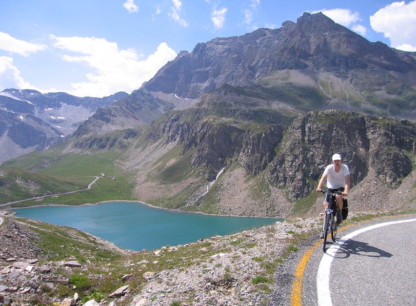
The program for this light, pleasant day was to visit the Sierra de Lujar that offers wonderful panorama to the sea and to the Sierra Nevada the target of the following day. I was amazed by this photo gallery about Sierra de Lujar : http://www.altimetrias.net/aspbk/verPerfilusu.asp?id=853
The climb of the Sierra de Lujar (1878 m) started at Castell de Ferro to that I had cycled 20 kms on the panoramic mountainsides or along the beaches of the Costa del Sol. After the first few light kms the following 7,7 kms were 8,9% steep - in the average, but there were 12-15% steep stretches.
With the experiences of the previous day I took more water, drink with me (bottles + extra 2 liter water +drink). The 8.10% steep section ascended on such mountainside that got the sunshine just perpendicular and I couldn't feel any wind and there was 1,5 kms between the trees. It was almost a total bare mountainside. It was like hell and memorable! After ca. 4-5 km I stopped the only tree there sat into the shadow and sat only not to feel the swelter. I only looked out from my head: "-It was brutal !" Not much before the village of Rubite I was surprised by the view of the Pico Veleta (3394 m). After a time I could feel a little bt of wind and in Rubite I found a wall fountain so I felt better. I went on cycling on a nice twisting and turning panoramic road to the ridge of the mountain, to the Puerto Camacho (1125 m) that offered great panorama to the Sierra Nevada and towards Castell de Ferro and the sea. Thanks to this I felt that there was no worth pedalling upwards farther. It was better to turn back and spare my strength for the following day. Standing on the ridge I sent a "message" to Pico Veleta : See You tomorrow !"
I went on bicycling with pleasure and without watching the time. I descended from Haza del Lino (1280 m) to the beach on a panoramic road. Along the sea the temperature was much milder than 1280 m higher. Yes, it's special. In the following day I planned to start the day at ca. sunrise to have enough time to cycle up to the Pico Veleta (3394 m) carrying the 27kgs weighted panniers on my bike.
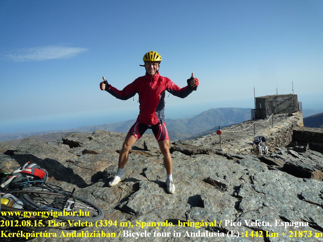
13th Aug, 2012.: – 4th day: Puerto Motril – Durcal - Granada – Monachil – Sierra Nevada település – Pico Veleta, above teh end of the paved road (3320 m) – place for wild camping (ca. 1500 m) = 149,7 km + 3779 m szint (own record !)
Totally till the end of that day:: 536,4 km + 8836 m
I woke up for the day I had been witing for few months. Although I woke up in darkness, but later I rolled to the beach - in front of teh camp - querter an hour after sunrise. Unfortunately the wind came back, so early in the day I realised that in headwind it would cost extra energy to cycle up to Granada, the start of the long ascent (with 2700 m heightdifference) to Pico Veleta. I knew that I woud need extra motivation willpower ! I was amazed by a great lake along the main road in front of the Sierra Nevada. In addition the highway had a viaduct above the lake. Not much later dozens of windmills showed that in that the valley should be windy. I was pushing the pedals on the hills in headwind and in heat. At ca. 1 pm I arrived at Granada and turned towards Monachil (805 m) which was the bottom of the harder, but not the main road up to Pico Veleta. After finding wonderful pictures about this climb I decided to climb this ascent. I bought 1.5 liter extra water and started the climb which first few kms were 10% steep.
Becasue the 10-12% section were changed for not too steep sections and the 15-17% steep part wasn't too long (ca. 500 m) so neither caused problems for me and beside the view gave me happiness. After the few km long mix of short ascents and descents I arrived at the Collado del Muerto (1492 m) that was followed by a ca. 1 km long descent - in a fir tree forest - to the main road. At the height of ca. 1900 m the road turned left and first I could see the Pico Veleta in front of me. That was the view of the following hours. From that point till the end I could see the remaining part of the ascent (1400-1500 m). Up to that time ca. 2400 m heightdifference were in my legs that day.
Normally as the time passes by it made me hurry, but this occasion it didn't happened, because it was very important for me to take enough pictures and make enough videofilm. At the upper part of Sierra Nevada village I bought extra 1 liter water + filled my bottles at a fountain and after ca. half past 8 pm (or later ?) I left the good road. That was the 236th occasion that I cycled above 2000 m.
Above 2500m a worse road (sometimes with potholes or no asphalt for a while) went above towards the peak. At 2600 m I met with friendly spanish cyclists coming from the peak and we chatted a little bit. They were surprised why I carry the heavy panniers :)
And not much later in dark. Why I cycled from the sea to the Pico Veleta ? For the joy, but in the background I was motivated to finish competing with it after that in the year 2011 I cycled the last missing paved ascents of the Alps, Pyrénées and Canary islands.
By middle serious wind I went on cycling upwards and after a while I needed warmer clothes and a jacket on me. I used lights to see the road and I didn't think how dangerous the road was, on how steep mountainside it ascended.
Sometimes I felt a little bit as I were at the end of the world, but the sight of Sierra Nevada and Granada helped me. My former memories of cycling in darkness also helped me: I cycled high finishing ascents minimum 7-8 times before that. Beside thinking of a girl - whom I loved - also helped me. At ca. 3250 m high the asphalt ended and at ca. 3300 m the road was closed by huge rocks. I decided to stop there: I cycled the highest finishing paved road of Europe in a day. That was my goal. Beside this I thought: not 1 climbs shows who is between the best climbers, but such things like cycling all of the paved ascents finishing above 2000 m in the Alps, Pyrenées, Canary islands. Looking down I could see the lights of the villages by the beach, sea and could see farther villages and Granada too.
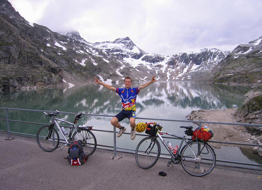
Because with my tourmate - who joined my a day later - we returned to Pico Veleta 2 days later in sunshine we had opportunity to enjoy the beautiful views by sunshine.
After hesitating I decided to sleep on a field at the height of ca. 1500 m.
Bicycle tour in Andalucia - Best of video I.
Aug 14, 2012 – 5th day: wild camp – Granada = 56,94 km + 97 m
Totally till the end of that day:593,3 km + 8933 m
The main task of the day was to find a bicycle mechanic who would be able to chenge the bicycle's broken spokes in Thursday morning. The problem was day rest day after the 15th August's holiday. After searching andd surfing in an internet cafe and then finding 3 mechanic at last I could find a small shop where the friendly man offered me to do it in an hour when I take my bike in Thursday morning. Oh' thanks ! I was happy, I had fortune. In the afternoon at about 5 pm we could find each other with Tamás, my toruing partner and after speaking enough we left the center to find the camping. In late afternoon we cycled and walked up to St Andreas' viewpoint which gave us wonderful viewe to the center, to the Alhambra and to the Sierra Nevada mountains and of course: Pico Veleta (3394 m). We finished the day at a restaurant; the fruit soup and the fried fish was great !
15th Aug, 2012 – 6th day: Granada – Cenes de la Vega – Sierra Nevada - Pico Veleta (3394 m) – Granada = 112,07 km + 2951 m
Totally till the end of that day: 705,4 km + 11884 m
Although we had a whole day for cycling up to the pak of Pico Veleta and back, we planned to start not too late to have enough time to look around and make enough photos, videos. Not far after leaving Granada we changed the waters in our bottles. The first part to the height of 1450 m (few houses there) didn't give so much interesting things, views.
The nature, the scenery, landscape got better above 1700 m. I enjoyed the situation that 2 days earlier I had cycled there and enjoyed the beauty again. Until the height of 2500m we didn't have much wind, but above the ridge we had to face with serious wind sometimes it was gale !
We felt it funny, when I cycled in backwind - thanks for the lower section of the bend - but 100 meters ahead of me Tamás cycled in headwind and struggled, had to push the pedals hard. We enjoyed the serpentine road, and feeling us as cycling on a local highest point, mountain and that every direction the landscape was above us. Because of the heavy wind sometimes Tamás stopped pedalling and got off the bike. At about 2900 m high as I was cycling on the steep and dangerous mountainside I remembered how I cycled there 2 days earlier in dark. Then I lighted the road with my small light and had no informations how steep the mountainside was.
At about 3200 m a bend offered the first views down to the Mediterranean sea. It was great and amazing! As we reached the bend awe found a mountain goat there, athough we couldn't see much grass, plant to eat. We could clearly see Motril, the Sierra Lujar mountain and next to it, Castell de Ferro, and East from it, El Ejido and the the agricultura plain.
On a rocky road-section Tamás was just walking next to his bike when the gale lifted it up into the air: it was amazing !!! Unbelievable !
The last meters of 3394 m high Pico Veleta meant a rock, it didn't offered opportunity to cycle. The wind was so strong that standing at the peak we didn't let us standing straight. The panorama was perfect: everything was under us.
Tamás' sharp eyes could see Gibraltar and Africa too. At the peak I measured 15 degrees Celsius, it was 7 degrees more than I measured 2 days earlier at midnight.
We started the descent after 7 pm and felt it cold (wearing short cycling trousers) till we reached the height of 1600-1800 m. We arrived back at Granada just after sunset.
As we remembered, thought back for our memories we thought that we had an amazing day ! We knew that that day would remain a memory that we would never forget and if we would have no other great memories in the remaining week it was worth visiting Andalucia just for that day on Pico Veleta.
Bicycle tour in Andalucia - Best of video II.
16th Aug, 2012 – 7th day: Granada – Cenes de la Vega – Quéntar – Guadix – La Calahorra = 80,15 km + 1134 m szint
Totally till the end of that day: 785,55 km + 13018 m
We started the day by the bicycle mechanic. Although we lost time with it I believed that before sunset we could reach Puerto Ragua (2000 m) and could descend on the southern side of Sierra Nevada.
After repairing my bike we left Granada in heat. As we turned to East after Cenes de la Vega the temperature and the weather felt very unpleasantly sweltering. If we could we changed the water in our bottles every 10 kms and we had an extra bottle of water in our panniers.
We were cycling between and on dry mountains with few scubs and not much after that I told Tamás how we could enjoy an oasis there, it happened ! We found a park with fresh green grass, totally green trees and a fountain with benches and next to the park there was a blue - turquoise dammed lake.
It was an ideal place to eat something. After few kms of cycling along the lake we had to ascend up to the 1297 m high Puerto de los Blancares. Its descent went through a very dry terrain, mountainsides.
We cycled closer and closer to the semi-desert of Tabernas. In Guadix we stopped for a little bit of time to enjoy some icecream in the shadow. It was 36 degrees Celsius.
As we were cycling paralell with the Sierra Nevada, we could watch its mountains and at teh bottom we could found La Calahorra village where we planned to sleep. We paid 25 EUR/ person for the night with breakfast. In the evening we walked a little bit in the village and we had an iteresting memory: the processional of the village. Just efore sleeping I showed few minutes of the video that I recorded previous day.
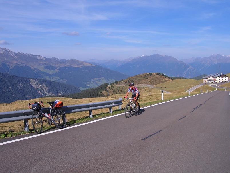
17. Aug, 2012 – 8th day: La Calahorra – Puerto de la Ragua (2000 m) – Bayárcal – Fondon (camp) – Ohanes – Abla – Escullar - Puerto Padilla (2036 m) – Abla – Ohanes – Fondon = 186,87 km + 3954 m
Totally till the end of that day: 972,42 km + 16972 m
We woke up early to start day not much after sunrise and have time in the afternoon for another climb: PUerto Pedilla / Escúllar (2036 m) which was a little bit farther from the planned camping. The 1st ascent of the day was Puerto Ragua (2000 m) with 800 m heightdifference and not so serious steepness. It was a lovely road often with views back to La Calahorra, to the agricultural meadows, and to the Sierra Nevada.
At the saddle we found great benches between the trees; it was an ideal place for eating something. Ot the southern descent at the level of ca 1500 m we turned to East and went on descending in hot air, through bare terrain, landscape. The south side of the Sierra Nevada offered not too sharp views, because the air was humid. After buying some food in a small village we needed shadow again to be able to sit down and eat by the 36 degrees Celsius warm weather. We set up out tent in the camp of Fondor, and then started our afternoon programme:
Tamás cycled a shorter tour, but my tour was more than 100 kms long, but in every case I wanted to climb up to the hardly known Puerto Escúllar and then introduce it with my video.
We started our tour together and were amazed by the view to the semi-desert. As we looked back the mountains seemed to be as they were in Marocco. For me it was amazing! I had never cycled in such a landscape. After enjoying the lovely mood of Ohanes village we said goodbye to each for that day.
Unfortunately the Santillana saddle was situated 100 m higher than I thought based on the map, so I lot a little bit of time. In the valley, in Abla (818 m) I bought a bottle of water and filled my bottles and then - at about 7 pm. - started the climb up to the 2036 m high Puerto Padilla / Escúllar on its 5-7% steep ascent. It was a mainly panoramic road; I could see a lot of windmills from the road, then above 1500 m the surface-quality became worse that made my sad.
The climb isn't a wonderful one, there are no great views, only "average views". There was no traffic during the climb and the ascent didn't give me much happyness, but than..... at the height of ca. 1900 m I caught sight of few deers. I stopped and took out my videocam quietly and then I could make a minute long video about them. I enjoyed it very much: they weren't afraid of me, but at last they slowly jogged away. That minute was the best of the whole ascent and descent. At the saddle there was no sign, information board. by the way, that was the 239th occasion that I cycled above 2000 m.
After descending with the help of my bike lights I ate enough at Abla (11 pm.) to have enough energy for the following two hours of cycling. I had no spare battery for my mp3-player so I struggled a little bit during the night. It was interesting that although it was after midnight when I reached the 1356 m high Puerto Santillana I didn't need to put on clothes for the descent: the short sleeved jersey was enough !
At 1 am I had another surprise: in a small village, Beires I stumbled into a local concert: a band was playing pleasant music in a park next of the church :) At 1 am I could hear it 1 km farther !
Fortunately I didn't made Tamás woke up when I arrived at the camp after half past 1 am. After this hard day (187 km + 3954 m) I had no chance to sleep enough and the following day was also planned not to be a light one: ca 150 kms on hilly, partly mountainous terrain and with the last climb finishning avove 2000 m: Tetica de Bacares. That was planned to be the last long day of this tour.
Videos: Puerto Ragua & Puerto Escúllar
18. Aug, 2012 – 9th day: Fondon – Canjáyar – Gador – Tabernas – Puerto de la Velefique – Tetica Bacares (2080 m) – Tabernas – Almeria / La Garoffa = 182,07 km + 2669 m
Totally till the end of that day: 1154,49 km + 19641 m
I wasn't let sleep more than 6 hours, but I didn't felt tired. I felt enough energy to cycle anothr 150-170 kms and visit the 2080 m high Tetica de Bacares. We started the day in the light descending, dry valley under some clouds. The Sun couldn't burn our skin, but it wasn't cold :) Every half an hour we felt that we are closer and closer to the Tabernas desert; the landscape was interesting.
The rarely shrubby vegetation indicated that the desert is not far away. Soon the landscape turned to be similar than in the western films. Few kilometers before Tabernas I stopped and walked on the meadow towards the filmstudio to make a short video about that. We could see the usual western buildings: saloon, mill, sherrif's office, indians' tents, etc. While Tamás went on cycling towards Almeria I cycled to Velefique village and from there up to Puerto Velefique (1860 m) and then Tetica de Bacares (2080 m).
Not muach after leaving Tabernas I found a place to hide my panniers and carried only ca. 3-4 kg weighted packs with me. The landscape was tipical as in the wild west, few bushes and mainly bare mountains and semi-desert. I felt dry when I arrived at velefique village that was the reason why I take 1.5 liters of water with me beside the 2 full bottles. It was betetr not to suppose to find a place along the climb to fill my bottles.
The ascent of Puerto Velefique is a great, panoramic climb, but unfortunately the air was too humid so I couldn't see the far-away mountains. I had to enjoy only the views of the serpentineroad. Few years ago the Vuelta a'Espagan visited this climb too, so I found a lot of painted words on the pavement. I was really surprised when I saw my favourite's name on the rockwall: Indurain! He is the best spanish cyclist of all time; he won the Tour de France 5 times in a row.
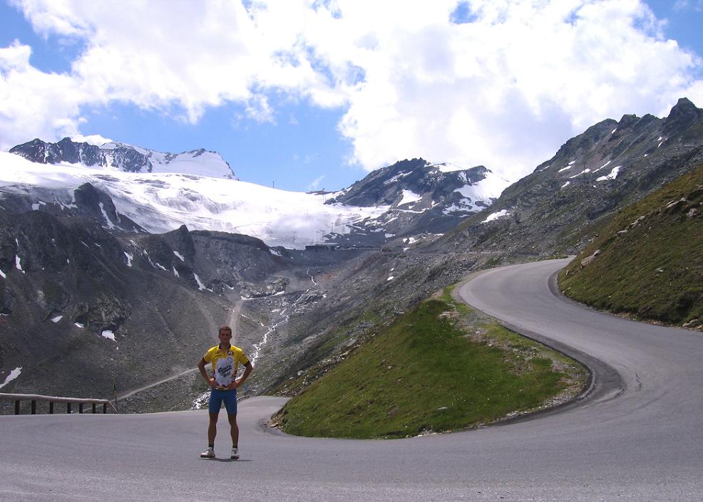
After reaching the saddle I caught sight of the target, the Tetica de Bacares (2080 m) but the following 2-3 kms were very light. The last 3 steep kms went up just to the TV ! radio tower of Tetica de Bacares. I reached the peak at sunset, so the landscape seemed to be grey enough, but I fould Calar Alto, the next cycleabe peak on the ridge.
I thought I remember well where I hid my panniers, but I was wrong. I needed 20 minutes to find them :) It wasn't so funny after 10 pm in the dark.
Leaving Tabernas behind me I was pedalling spiritfully so after 100 minutes at half past midnight I arrived at the camp past Almeria and found Tamás still awake. We arribed at the coast of the Mediterranean sea so I finished the series of the long, mountainous days :) There were no serious plan for the following days only to enjoy the ride, the sea, etc...
Videos: 9th day with semi-desert & Tetica de Bacares
19, Aug, 2012 - 10th day : La Garoffa – El Ejido – Adra – Castell de Ferro = 90,1 km + 742 m
Totally till the end of that day: 1244,59 km + 20383 m
After waking up and swimming a little bit in the sea we had to cycle about 90 km along the coast to the planned camp at Castell de Ferro. The 1st half was boring on the plain terrain and with boring villages, and lot of agricultural buildings. We sea was waving ca. 10 kms farther. Between our road and the sea agricultural foils, tents, few houses were built, could be seen. After a while my sholders didn't feel happy to keep the same position for so long, I needed a short stop. Once I tried to break the boring cycling when I increased our speed.
Ca. 20-30kms before Castell de Ferro the landscape became better, nicer : we were cycling again along the sea, just at the feet of the mountains. As the Sun came out from behind the clouds the lights turned to be better and we saw the landscape more beautiful. That was again the weather of bathing in the sea. The camp of Castell Ferro is one of my favourites campsite: . friendly and is situated only ca. 30 meters from the sea, the beach, but for me. the reason why I fellin love with it was that is was like an arboretum: lot of interesting plants and each of them were waring a short description about the plant. . In the following day we spent half an hour to read few dozens of descriptions and taking photos abou them. In the evening we were swimming and bathing in the sea. After it, as we were walking back I was stared by people who were wondering the serious contrant of the colours of my legs.
Usually I wear bicycle trousers so my thigh were bright, but under it tanned, brown. Most of the people didn't understand how it could happen. I was walking back with Tamás, that was the reason I didn't feel it so unpleasant. Once Tamás was asked what happened with me, what caused this strange "stituation" on / with my legs.
We had supper at a restaurant where we ordered dorada and gambas. It was interesting that the vendors took their places along the pedestrian zone at about 9 pm. That was the time when more and more tourists came out there. :)
20th Aug, 2012 – 11th day : Castell de Ferro – turquoise bay – Castell de Ferro = 18 km + 256 m
Totally till the end of that day: 1262,59 km + 20639 m
That was a calm day withour any hurry. It was about spending the time by the beach. We visited a lovely, romantic, rocky bay situated ca. 10kms far from Castell de Ferro. However it was very attractive, a lot of the sea-jelly were swimming in the sea so it wasn't ideal for us to swim. Most of the people were sunbathing and only a few ones went into the sea. There were 3-5 tourist who were fishing the sea-jellies. In the afternoon I cycled back to Castell de Ferro where I could swim in the endless sea without any risk.
21st Aug, 2012 – 12th day : Castell de Ferro – Almunecar – Nerja – Malaga - Torremolinos = 146,1 km + 1115 m
Totally till the end of that day: 1408,69 km + 21754 m
That was the day of saying goodbye to each other. In the morning we wished all the best to each other and I went on cycling to Malaga, from where my airplate started in the following day. Tamás had 2 days left for swimming cycling before flying back to Hungary. We said thanks for the tour and then I left Castell de Ferro. I started early in the morning to be abe to be after the 1st 100 kms not much after noon. I was fimiliar with the route as I were cycling there 10-11 days ago. The weather wasn't so wonderful than I had earlier so there was less reason to stop so often. Rincon de la Victoria was the village that I loved in the 1st evening in dark so 11 days later I stopped for a great icecream :) It was so delicious that I sent an sms to tell Tamás that he should try it 2 days later. I arrived at Malaga at 6 pm, where I could buy postcards to my family. Cycling towards the camp of Torremolinos I was surprised that I had to use the 3 lane wide road; that was no other choice. It wasn't forbidden.
After setting up my tent I looked around to buy some chocholate or other delicious things for my family and collegues. I needed not much time to realise that there are not many spanish sweets in Lidl or Aldi, but I had fortune to find a proper shop.
22nd, Aug, 2012 - 13th day : Torremolinos – airport – FLIGHT - Schwechat – Gramatneisiedl – TRAIN - Győr = 33 km + 119 m
Totally till the end of that day: 1441,69 km + 21873 m
I was surprised that the last morning could show me interesting great view! As I cycled few kms to the airport there was mist / fog there. The same that I experienced 12 days previously, when I arrived. There was 30 degrees Celsius and it happened in summer !
Fortunately it wasn't a problem to find the airport, where I had much time to arrange my packs, panniers and cover my bicycle. I had enough time to find a cumputer and send messages to my family. After taking off I enjoyed how the mist / fog covered the bay and how it ended in a ca. 10-20km long distance. At the airport of Schwechat my panniers and bike arrived very early so after that I had to cycle to the train station without any hurry. At the end of the day I slept in Hungary, in my home country :)
I finished the last of those tours that contained serious motivation. I thought that in the future I wouldn't search very motivating cycling targets, aims; I thought to spend more time in connection with my private life.
With this tour I reached the last cycling goal that was important for me.
Till the end of 2012 I cycled, climbed all of th eknown, listed, paved ascent of the Alps, Pyrénées and Canary islands finishing above 2000 m and till the spring of 2016 I would finish the project to have the 1st and only cycling video collection about ALL of the paved ascents of the Alps finishing above 2000 m (160 climbs).


")
")


")


