Györgyi Gábor: Bicycle tour in the Swiss and Italian Alps - indulging in nostalgia
GÁBOR GYÖRGYI
Nostalgic bicycle tour in the Swiss & Italian Alps and collecting all of the paved roads going above 2000 m in the Alps
14.July -02. Aug, 2011. : 2358 km + 49663 m height difference
Introduction:
As I wrote in the introduction of my travelogue of the bicycle tour in the French Alps in June, 2011, in the beginning of the year I decided to finish collecting all of the paved ascents of the Alps going above 2000 m.
In Hungary (don’t mean only BIG members) I could feel a – non spoken – rivalry and felt there are few cyclist who wanted to defeat, exceed my results that I had reached on the ascents in the Alps, Pyrenées and Canary islands, I decided to finish collecting the paved ascents going above 2000m in the year of 2011 after I collected all of them. I knew that my aim meant more than 35 new ascents going above 2000m and ca. 40 cycling days in the Alps, of course with cycling between the bottom of the climbs too. After the last few years with Raidf Pyrenéen, the Galerian level of the Club de Cinglés du Mont Ventoux or the Ötztaler radmarathon / bicycle marathon that was the last serious challenge that motivated me.
I analysed the ca. 15 best and detailled list of climbs of the internet / web, like salite.ch / climbbybike.com / quaeldich.de, etc.) and based my plan on the missing ascents. After often visiting those sites and searching for new paved climbs I thought that I knew all of the climbs that was known between cyclists as asphalted road going above 2000 m. There were a few such ascents about which there were minimal informations found on the internet, so I asked other cyclists of the UIC / cicloscalatori.it maillist if they could help me with the last two ascents. Fortunatelly I got the necessary informations about Dondenaz (not paved) and Albertüsc (Switzerland). Based on the experiences I had in the last hurry, busy days of my French Alps bicycle tour I decided to cancel the participation in the Monte Grappa challenge. In the year of 2010 I succeeded in finishing the Ötztaler radmarathon / bicycle marathon in time and doing the Galerien version of the Club des Cinglés du Mont Ventoux (for me 6126 m heightdifference), so the Monte Grappa challenge wasn’t so important event, than having the total collection of the paved roads above 2000 m in the Alps. Thanks for the 3 days that I won with this decision, I could ease my plan and could take into consideration a few additional optional climbs during finalizing my plan. I thought the plan / schedule chenged for more enjoyable. Without the change the last 3 days would have remained brutal hard.
In June in the French Alps I was cycling with feeling nostalgy, remembering my memories of the previous bicycle tours and adventures on the ascents of Bonette, Galibier, Iseran and the others, not to famous ascents, but considering the swiss and italian Alps, Th ere were climbs there too, where I had memories to remember. Such better known climbs were Col du Grand Saint Bernard (2469 m), that I cycled in 2001, the Nufenenpass / Passo NOvena (2478 m), that I ascended from East in 2005 or the Passo San Gottardo that I cycled one day before the Nufenenpass in 2005. I also wanted to return Splügenpass (2113 m) and the last well known pass / saddle where I wanted to cycle back to visit a new climb its northern side was the legendary Passo di Gavia (2621 m), but now from the opposite – southern - side, than I ascended it in 2005.
Feelings, desperation, motivation:
I was optimistic to finish succesful the tour because I eased it, as I mentioned above. However it was planned to be minimum 2300 kms long with more than 50.000 m heightdifference, I felt there wasn’t any too serious, risky day, adventure in the schedule. The task seemed to be simple: only to cycle itt o the end.
The sometimes rainy bicycle tour in the French Alps in June showed how to solve that situations and to live with cycling hours in the rain, even on climbs above 2000 m. I didn’t want to have similar, so many rainy days, but I thought: if I have rainy or cold days, I will solve it.
I was motivated that through the tour I would visit such ascents about which there are no or minimal cycling informations in the internet and I wanted to be who would be able to spread those informations, descriptions, steepness profiles and videos to the cyclists on my website or on salaite.ch, quaeldich.de, etc. An example: when I arrived home from my bicycle tour in the French Alps and send some informations abou the climb Plan du Lac to the mentioned maillist, few weeks later I (hungarian guy and not a cyclist from the Alps) was asked to inform them about the beauty of that climb. That’s a great feeling to give informations as a hungarian guy to cyclists, living in the Alps about alpine ascents which they don’t know. And it was great to change informations, suggestions, ideas with the famous cyclist, Jerry Nilson about climbs that the other doesn’t know.
15th June, 2011. – 2nd day: Ponte Ticino – Novara – TRAIN – Chatillon – Breuil Cervinia (2004 – 2140 m) – Valtournenche – Cheneil (2040 m) – Chatillon – Aosta = 107,6 km + 2204 m heightdifference
I woke up for pleasant summer weather in the same camping where I slept ca. 5 weeks earlier, during my bicycle tour in the French Alps. After cycling more than half an hour I reached Novara, from where I travelled by train to Chatillon. I started cycling towards Breuil Cervinia in hot weather. The 27 km long ascent with ca. 1500 m heightdifference goes under the rockwalls of the famous Matterhorn / Monte Cervino (4478 m), which is considered one of the most beautiful mountains of the world, but it’s true: from the northern side. Because after the ascend I descended on the same road I preferred hiding most of my 26kgs weighted panniers, packs. The 1st part of the climb wasn’t too interesting. The first beautiful place was St Andrés, from where the huge Matterhorn could be seen. My legs weren’t warm enough for the 3 week long tour, so the climb wasn’t so pleasant than it could have been, but I reached Breuil Cervinia without struggling. The touristic village is written to be situated at 2006m, but I searched the highest street above it, so I cycled up to 2140 m.
Between the steep and high mountains the Sun went down after 6 pm. or half past 6, but fortunatelly, when I was cycling from Valtournenche to Cheneil (2023 m), a hardly known parking place and village on the eastern side of the valley, I could enjoy the sunshine. From a few places there were great views, but otherwise it was an average nice climb. Backwards to Chatillon, I was surprised how the air cooled, even how warm the day had been before. After finding my packs and preparing my bicycle I cycled ca. 20 kms to West to find a proper camping not much before Aosta. I had an ideal starting day, it was ideal for warming up.
After my tour I uploaded the description about it to quaeldich.de and the profile to salite.ch.
16th June, 2011, Saturday: Pre St Didier – Val Ferret, Rifugio Elena (2061 m) – Pre St Didier – Col du Petit St Bernard (2188 m) – Les Suches (2200 m) – La Thuile – Colle San Carlo (1950 m) – Morgex = 120,44 km + 2884 m heightdifference
I travelled by an early train from Aosta to Pre St Didier not far from the Mont Blanc (4810 m), because I planned my bicycle tour there. Looking at the snowy peak under the clear sky I was amazed. It was wonderful, so I felt excited about cycling just under the high mountains, in Val Ferret. I decided to start with Val Ferret and go non cycling up to Col du Petit St Bernard and Les Suches in the afternoon, when clouds were forecasted. As I were cycling to Courmayeur I enjoyed the scenery, and this feeling increased / rose as I got closer to the Mont Blanc and Grand Jorasses. Val Ferret is a small valley there, so I was surprised by the numbers of the cars and the traffic; it was weekend. I enjoyed the beauty of the stream, the fir trees, glaciers, snow meadows and the mountains under the blue sky. Although ther road’s width became narrower, the number of cars didn’t decreased. Every 3 minutes another one overcame me. Unfortunately the paved road ended at a 1776 m situated restaurant, from where I could see the 12-15% steep road to the Rifugio Elena (2061 m). Because I cycled up so high I decided to keep on cycling up there. It was a panoramic road opposite of the Pre de Bard glacier and beautiful mountains and view back to the valley. I met with a mountainbiker and a pair who wasn’t strong enough for the climb, so they walked next to their bikes. I sent an sms to my parents: „-Maybe this will be the most beautiful day of the tour?"
In the afternoon first I cycled up to the 2188 m high Col du Petit St Bernard, which was my last pass of my bicycle tour in the French Alps 3-4 weeks earlier and which I reached at ca. 11 pm. after two rains. The first half was not too interesting, only the bands with a few views to the Mont Blanc covered by clouds, but after La Thuile there were more views so I enjoyed it. During the last few kilometers The wind of the weather front arrived and surprisingly I got a little bit rain at the saddle. I bought some souvenir, put on my rainclothes and left the pass: I cycled 400 meters in France. After ca. 5 kms I turned right to cycle the hardly known ascent to Les Suches (2200 m) with its 9-12% steep and 2-3 km long ascent. The weather was cloudy and looking around it rained at some places. From the few houses of Les Suches I could see lower the Colle San Carlo (1950 m) which was my following target. That was mainly a panoramic ascent where I had to stop three times to change my clothes: it rained for few minutes, then it stopped, than again it rained… I had not too much time to be able to catch the train, but I could take some pictures and record few minutes long videofilm. On the descent I had fortune that I didn’t have to face with too much water on the road; it was only drizzling rain, so the descent wasn’t too risky. Arriving at the train station of Morgex I felt, I had that even of the changed weather I had a beautiful and great day.
17th July, 2011 – Sunday: Aosta – Doues – Champillon (2078 m) – Étroubles – Col du Grand St Bernard (2069 m) – Martigny = 123,48 km + 3042 m heightdifference (4393 kcal)
Based on my schedule another ascend finisahing above 2000 m was planned for the day: first the 2078 m Champillon without heavy panniers and than the 2469 m high Col du Grand Saint Bernard that I visited last time 10 years earlier, in the year of 2001. Then I cycled it without panniers, so I enjoyed to return cycling my bike with panniers on it. As a serious cyclotourer I’m proud of cycling more than 50 high passes, carrying 25-26 kg weighted panniers on my bicycle which is not so frequent between cyclists, because during my tours I hardly met bicycletourers with panniers. I cycled almost all of the passes of the Alps and Pyrenées above 2500 m minimum once when my bike was carrying panniers.
In the morning I had fortune not to have rain during breaking camp, but after finishing my breakfast in the park opposite of the train station, it started raining. Wearing rainclothes I arrived at a small village towards Champillon which was not far from the main road going to the Col du Grand Saint Bernard, so it was ideal to hide my packs. I didn’t find bushes or places I wanted, so at last I left my packs in a hovel next to old houses where I didn’t find any people. To be sure I left there a note: „I will be back in 3 hours".
I was pedalling in hopeless, cloudy, rainy weather. Under ca 1600-1700m it wasn’t cold, so I put on the rainjacket just onto my jearsey to ramain my long-arm jerseys dry. In the following, colder days I tries to do the same, but it wasn’t so good to wear the rainjacket on my short sleeved jersey. It was useful: if I had used my long sleeved jerseys and let them wet, I would have had less (not enough?) dry long sleeves jerseys for the night in the tent. I had to be careful with using too many clothes in rain and had to spare with the clothes.
I rarely stopped for taking few photos or record videofilm and during upwards I listened music to take rainy cycling easier. I took a 10 minutes long stop when I ate something but that short stop was enough not to cool down too much. Cycling above 1700 m I was thinking where to change my clothes and hoped for a proper place for that. The last km was very cold with wind between the rare trees. By the end of the pavement there was a parking place and the wind blew the rain. It was awful, so I quickly turned back. Fortunately half km from the top I found a house without any people there but with an open door a mechanic room or not finished room at the ground floor. I could change my wet clothes there and spend les sthan half an hour with warming me up: I took some exercises. I was afraid of catching cold. Sometimes I shivered. By similar situations as lot of cyclists are waited by a warm car or apartment house I had to descend in rain and keep on cycling up to the 2469m high Col du Grand St Bernard.
My dry clothes were enough for the descent and after I found my packs as I was taking them onto my bike I warmed my up, and after the 10% steep following km I didn’t feel me cold. The rain eased around 4 pm, so cycling above 1400 m more and more sunshine lighted the valley and the mountains. I had great weather for the upper section, so – I hadn’t believe before – I could enjoy cycling in beautiful landscape. In the last hour of ascending in cycled in shadows, so I needed long sleeves cycling trousers. I enjoyed reaching the pass and returning there after 10 years time and entering Switzerland. Because of the low temperatures I put on a lot of warm clothes (long sleeved polar jersey, another jersey, jacket, raintrousers and winter cap and shoe cover too to keep my feet warm), while I was watched curiously by few people sitting in the warm restaurant. In the night I checked my POLAR odometer and it measured 4 degrees Celsius.
Thanks the proper clothing I didn’t feel cold during the hour long descent. I arrived Martigny – where I cycled minimum twice before – in dark, where I found a map to find the camp. After I set up my tent and had pleasant shower when I turned off my lights I hardly remembered the unpleasant rainy hours, but I thought I had a successful and memorable day.
I was satisfied.
18th July, 2011 - Monday: Martigny - Col de la Forclaz - Lac Emosson and the small hill above (2003 m) - Martigny – TRAIN – Visp = 83,4 km + 2480 m
It was planned for a calm, moderate day with one obligatory ascent finishing above 2000 m and there was an option for visiting another climb, that was listed in the challenge-big.eu’s collection. The information about the target, Lac Emosson (1970 m) and the above situated Lac Vieux Emosson came from a cycling site, (www.cycling-challenge.com), whose site is well designed and it’s name (cycling-challenge) is smart, but the contain (pieces of roads going above 2000 m) is much less than my collection. „My cycling challenge is more serious ".Although his description about that climb was very useful with his wonderful picture.
In the morning I rolled into the center to purchase some food, then I washed my clothes (the windy weather was ideal for drying quickly), so I started my tour around noon.
The Col de la Forclaz (1527 m) is said to be as hard as the legendary Alpe d’Huaz, while the parameters of the ascent are almost the same: 13 km with 1010 m heightdifference. In the first few kilometers there were nice views to the Rhone valley and Martigny, but later the road often ascended in the forest , so there was no reason for stop too often. I listened music from my Mp3 payer, because the traffic didn’t let hear the nature’s voices. This was a hard climb with rare views which offered me string headwind in the last 2 kms. It was a windy day. On the few km long slope the road descended lower (1066 m) than I hoped, so I had to face with another more than 900 m heightdifference to cycle above 2000 m, by the Lac Emosson. The lower part wasn’t too interesting, but cycling upwards the view became more and more beautiful and after a time the scattering clouds let me see a glacier on the opposite mountainside. After cycling by a sign of Col de la Guelaz (1965 m) I arrived at the parking place (1970 m) of the Lac Emosson. Behind the lake I could see the road to the higher situated Lac Vieux Emosson well, so I looked around how to catch the road on the dam. Carrying my bicycle I walked down on stairs to the dam, where the road was separated from the place where the pedestrians could walk. They weren’t let use the road. There was serious constructing at the other side of the dam, where I should have to lift my bike above the barrier, so I asked the warden there is I could cycle higher up, but he told me: it isn’t allowed. Traffic is closed expect of the trucks working at the constructing area. Cycling back I lifted my bike above the barrier and used the road on the dam and I could cycle up to the parking place on a short ascent. Where I arrived back at the parking place I found a sign, wraning that cyclists aren’t allowed use the dam. That’s the reason why the road to Lac Vieux Emosson couldn’t be considered as an accessible paved road going above 2000m.
After that I cycled more than 3 and a half hours to reach the lake I had to find a proper roac where I could cycle up above 2000 m. There was a small chapel little bit higher, but I missed few meters, so I kept on cycling op on a little bit rocky dirt road along the mountainside. It finished at a 2003m high situated panoramic place, which offered great views down to the ascent and towards Martigny trough the valley.
Returning to the valley I cycled back to Col de la Forclaz lively, but I spent much time with taking a great picture by the last bend of the ascent with a great, snowy mountain and glacier in the background. I lost too much time, so after I arrived back to Martigny (76 km/h on the descent) I had to hurry very much with breaking the camp. There wasn’t order in the tent, but nevertheless 26 minutes later I cycled outside of the camping and tried to cycle by fast pace to catch the train. I used my memories towards the train station but I could find it after I asked a man on the street. I could buy my ticket by an automatic ticket machine: travelling by train is very expensice in Switzerland !
In the year of 2006 and I was cycling trough the whole valley, so I didn’t waste time for doing that again. I arrived at Visp at half past 8 and could set up my tent before sunset.
19th July, 2011: Sion – Alpage Mandelon (2066 m) – Sion – Sierre – Crans Montana (1476 m) – Sierre: 102 km + 2578 m heightdiff.:
After my parents informed me about the weather forecast for this and the following day it seemed to better to visit Alpage Mandelon this day and postpone the more serious one (with Weritzalp, Lauchernalp and Zmutt above Zermatt) for the following day, when I hoped to be better. For this afternoon clouds and rain was forecasted.
I started the day under clouds and got the rain at the half of the ascent of Alpage Mandelon. There was no cycling information about this climb on the internet, that motivated me. This climb is not far from the BIG, Barrage de la Grand Dixence, that I visited already in 2009. Then I didn’t have informations about Alpage Mandelon, that’s why I didn’t climbed. I had to turn left and leave the road going to Barrage de la Grand Dixencee at the height of 1567 m, Leteygeon.
I ascended it in rain but I felt well and happy to visit it even in rain. Although it wasn’t a known climb there were painted words, signs on the pavement for cyclists. The last 2-3 km long section offered views, but the landscape was cloudy. I reached the Alpage de Mandelon parking place (2066 m) between clouds, fog, so I didn’t spend there too much time. On the descent sometimes it was better lift my legs up not to got water from the pavement. At some places water was flowing on the road.
Because I had enough time and the weather seemed to be better, I decided to climb a BIG: Crans Montana (1476 m). I ate sandwiches in Sion and as I were cycling towards Sierre the rain stopped and the clouds started to be lighter. I started to cycle the western ascent through Lens. In the first few kms I could cycle wearing light jerseys, but above 900 m the rain returned, so I had tp keep on cycling in rain and later in fog (look pictures and video!). Even the cold weather wasn’t a reason to put on warmer jerseys under the rainjacket, because I needed that for the descent. I reached the top, the lake in heavy rain; it was raining cats and dogs and I saw that a thermometer showed 6-7degrees Celsius. That caused to express my opinion inside my mind: I had no other choice to climb that, so if I wanted to collect a BIG I would have to face with bad weather. Others who live closer, or can afford to travel there at an other weekend, they can choose the right weather for cycling, that’s why sometimes
I have to cycle by worse weather. Because of the rivalry. That was the first step when I thought: is this the right comparison about who are the best cycloclimbers ? I understood seriously that the ranking couldn’t clearly show who are the best cycloclimbers. I felt upset that to keep at a good place on the BIG ranking, I should cycle, climb in rain just because I live far away from the Alps and instead of driving a car I cycle between the climbs, if I hadn’t cycled there earlier. That was the 1st step in a process about thinking what is really important for me in cyclotouring and in my life in connection with bicycling. I managed to finish the Ötztaler radmarathon / bicycle marathon in time by my touring bicycle, up to that day I cycled nearly 200 times above 2000 m and nearly 50 times of them happened wehn I was carrying 25-26 kg weighted panniers on my bicycle. Mostly I sleep in tent…. Most of the cyclists of the Alps what these things mean. Few times when I met a cyclist on a light racebike I heard that he / they couldn’t imagine how is cycling a heavy bike with panniers. That’s the truth. It’s „not the same" to cycle long climbs by a 8-10 kg weighted bicycle or by a 13+26 kg weighted bicycle with panniers.
On the descent to Sierre I had to be careful, because somewhere much water was rolling / flowing on the road and my brake is an average brake, not a „upper class" brake, not V-brake". In 2-3 bends I had to keep my fingers cross that the bike should slow in time.
At the train station I moved my body, I tried to keep me warm and as I arrived at the camp I hurried to have a hot shower. I enjoyed the best minutes of the day there: just standing, enjoying the hot water and grinning.
20th July, 2011 – 7th day: Zermatt – Zmutt – road by ZMutt, abobe the lake (2008 m) – Zermatt – Visp – Steg – Wiler – Lauchneralp (2052 m) – Weritzalp (2099 m) – Fafleralp (1763 m) – Steg – Visp = 150,3 km + 2654 m heightdifference
I woke up for bad, windy weather with drizzling rain. Based on the informations I got from my parents, from Hungary it seemed that around noon the weather could be sunnier, so I prepared calmly and decided to reach Tätsch by train (in 2009 I had already cycled up to Tätsch). From the camp I saw that the cloudy are lighter towards Zermatt. Originally the whole tour would have started from the camp, but by much warmer, better weather conditions. The train ticket was very-very expensive in that famous valley, but I quickly banished these thoughts and trought only that in every case I would manage to finish the day, to visit the planned climbs na dremain healthy.
I knew that drivers aren’t allowed to go to Zermatt, so I was surprised when - during cycling on that narrow road I was overcome by few cars. I was wearing a warm jogging trousers on my legs, because I had autumn weather. In Zermatt at a point I chose the left road, so I didn’t cross the center – I realized that later. I saw a outdoor thermometer showing 8 degrees Celsius at noon. The paved road towards Zmutt and the mountain lake ascended on the left mountainside of the stream. First it twisted and turned mainly in the forest, but above ca. 1800m it went throught meadows and went by few houses and a cable-car station. The Sun started to light a little bit between the clouds and they started scattering. Even these things I needed my headband on my forehead. The paved road finished at the 1970m high situated lake, but of course I kept on cycling above 2000 m; exactly: 2008m on the dirt road. Downwards the views were better than an hour earlier and I could see freshly snow-covered mountains and the famous Gornergrat could be seen too with its open-air rack railway line.
I looked around in the center of Zermatt, than I quickly cycled back to the camp, where I spent an hour with eating something and washing clothes for the following days. In the afternoon 2 serious ascent waited for me. Of course, they are situated above 2000 m.
I pushed the pedals half an hur long in the Rhone valley, then I turned North into the Löschental, which is famous about the train that carry cars in a tunnel to North Switzerland. Even the 2 km long tunnel cycling is allowed in that long tunnel. Although in the first few kms I had facewind, after I came out of the tunnel fortunately the wind was over, but it wasn’t warm.
After a few km long almost flat section I found the junction. One steep mountain road starts towards Weritzalp (2099 m) and Lauchernalp which has a junction at 1872 m. The left road goes up to lauchernalp, the right to Weritzalp. The ascent started with 10-12% steepness which eased a little bit later. The road twisted and turned mainly in the forest but sometimes there were views to the opposite mountains or to Fafleralp, and Langglacier at the end of the valley. I didn’t have any problems with my condition, so the steepness at the end of the day didn’t cause problem. After a time I realized as it rained on a mountain 10 km away from me and hoped not to reach me. First I visited Lauchernalp, than Weritzalp, which last kms were steeper. I arrived at the 2099 m high situated village after sunset, after 9:30 om, so I had to hurry back to have some lights during descending.
I turned to the BIG (challenge-big.eu) listed Fafleralp (1763 m) in darkness: I had to cycle another 10kms but only with ca. 400 m heightdifference, 2-7 % steepness and only 1 km long 9,5% steep part. It was „funny" to cycle a light ascent to have a BIG climb, after I cycled 1-2 much harder ones, but it’s true that by selecting the BIG listed climbs not only the hardness what could be important.
I reached Fafleralp at 10:40 pm, where I put on enough clothes for the descent. I enjoyed the lighted tunnel, where I didn’t have to be careful; I could let the bike roll down fast. I didn’t miss the remaining 12 kms in the valley. I finished my tour after midnight and got to sleep at half past 1 am. I had another partly unpleasant, but succesful day.
21st July, 2011 – 8th day: Interlaken – Grindelwald – Bussalp – Oberläger (2025 m) – Grindelwald – Interlaken = 67,4 km + 1466 m heightdifferenceemelkedés
I woke up after not too much sleeping to be able to travel to Interlaken (where I cycled in 2001) by train, from where I wanted to cycle up to the 2025m high Oberläger. It wasn’t a cheap travel either, but quickly I forgot it and thought that Oberläger would be the 200.th occasion, when I cycle(d) above 2000 m. I arrived in Interlaken under changeable clouds, but when I wanted to leave the train station it started raining. I had enough time, so I waited for a while, sat in the waiting room and watched the monitors which showed the weather conditions at Männlichen (9 degrees Celsius)(2229m, where I cycled in 2009) and Shilthorn (2970 m – 1 degrees Celsius, sometimes it snowed). The foggy, snowy pictures showed it wasn’t cycling weather! After ca. an hour long waiting, the Sun came out so I left Interlaken. I cycled only 5-7 kms, when I could see rain falling by the next village, so not much after it I had to stop to put on my rainclothes. Looking straight ahead the weather didn’t seem as it could give me enough hope. It seemed to be another rainy day, so I sent an sms to Hungary, that: „-Maybe the subtitle of the tour would be: „How I became rain cyclists / rain man…"
Years earlier if I got a rainy day I often waited for a day and kept on cycling one day later, but now, in 2011 I was so motivated and have no time to loose that I wasn’t affected by the rain. I climbed the ascents going above 2000 m in sunshine or rain or cold or windy weather.
Based on the few day long weather forecast that I read or got, I felt more and more that the whole tour would be a test, proof, ordeal. I felt that during the whole tour I would have bad weather and during the remaining 2 weeks that would be the point how I could face with the bad circumstances, how much spirit I have, am I strong enough to manage to finish the tour and collect the missing climbs in such circumstances.
By the junction in Grindelwald I read through the quaeldich.de’s description about the climb and it wrote 20% steepness for a half km long section in the beginning. It was true! I pushed the pedals there in rain and after going trough that 10-11% steep kilometers followed each other. Although it was a panoramic road I could see only the rain and the clouds…. for a while. When I reached the level of ca. 1500m, when the weather started to change a little; the rain was over and the clouds began to scatter and broke up for 3 different levels. I could see the 3701 m freshly snowed Wetterhorn and I could see more and more about the Eiger – Mönch – Jungfrau trio. After a time I could enjoy cycling there, although the sky wasn’t blue, but the scattered cloudy panorama was interesting. I could use my videocamera during pushing the pedals. Reaching Bussalp (1800 m) not much more than 200 m I missed, but the last km was very steep (13-16%) and hard! Along the last half km cows were grazing, I cycled next to them carefully and was careful because of the messy few hundred meters with cowshit on it. I reached Oberläger (2025 m) : I cycled above 2000 m for the 200th times.
Downwards I enjoyed the descent and the panorama and I laughed when I saw the cows licking my rucksack on my bike that I leaned against the barrier. Later I recorded marmottes for video, so I had to hurry towards Interlaken to be able to catch the right train. It would have been my tour if it hadn’t start raining 9 kms before Interlaken.
I arrived in Visp at 8 pm, so I could get to sleep in time. I needed it, because the following day was one of (or only) the „king’s stage" of my whole tour with more than 3000 m heightdifference and with the highest pass (Nufenenpass, 2478 m) cycled by my touringbike with heavy panniers on it.
22th July, 2011 – 9th day: Visp – Mörel – Bettmeralp (2040 m) – Mörel – Ulrichen – Nufenenpass (2478 m) – Airolo = 127 km + 3384 m heightdifference
The weather forecast was good for this day, it was planned for a milestone of the whole tour, so I broke the camp with thinking motivated for the day. After breakfast I pushed the pedals to Brig with good mood in my head, but after a detour and then a not proper road-signing made me upset. I kept on cycling on the lightly ascenting valley to Mörel, where I turned left for another hardly knows mountainroad to Bettmeralp. I found it on quaeldich.de. After leaving the village I had to ascend 1 km to find a proper place to hide most of my panniers, packs. The narrow mountainroad often gave views to great, snowy mountains and after a time I realized that Matterhorn / Monte Cervino can be seen too. After a while I found weed growing in the middle of the road and not much after the road became a dirt road. In little worse mood I kept on cycling upwards and didn’t understand the situation, while I read that the ascent is totally paved. At ca. 1800 m high I saw a paved road going up and managed to join that road. The holiday-village seemed not to be closer and closer. The village really surprised me: it was a serious village with tennis court, lot of accomodations. The village had wonderful panorama and the houses, streets were well ordered. At the top of the village I found a friendly mountain lake where people were watercycling and cows were grazing. It was beautiful. The road ended at a farm situated at 2040 m. I ejoyed the beauty, the landscape the calm nature and then I descended back and listened where I could lost the proper road. The descent was more beautiful where I cycled up. At a place I stopped and took picture and recorded videofilm as I cycled upwards.
After I took my hided panniers and prepared the bike the steepness of the main valley increased. I cycled to Fietsch, where I stoped for eat something and where I spend a cold night in the camp in 2006. I couldn’t remember how high the road ascends towards Ulrichen, so I felt upset when I realized that the road ascended higher than that village, so I arrived in Ulrichen after descending a little bit. Fort he last hour a darker grey could arrived above me and brought colder air and wind and made the air cool down. Basel the morning and the time that I spend on the mountainside of bettmeralp it seemed to be a wonderful day, but after the valley and the cooled air I became angry: „-Even the beautiful days could became bad ?" „Will I have a perfect day during the tour?"
I knew that Nufenenpass / Passo Novena (2478 m) , that I had already climbed in 2005, is a serious ascent (13 km with 8,5% steepness) from West, so I was a little bit afraid of it and afraid of how much I would have to struggle. After taking eough energy from food I began the ascent wearing long sleeved trousers. Fortunately the headwind was over and I didn’t have to face with wind. Because of it’s steepness and my panniers I often pedalled in the way when I’m standing out from the saddle, but I wasn’t struggling and I could record great videofilm on the ascent. I was motivated by that ascent, because I thought: that is the hardest climb of the tour I had to ascend with heavy panniers on the bike. I was going up with rare stops, but enough photos, videofilms. After a time I saw that it was raining inn the Rhone valley, and hoped not to turn to follow me.
At 2303m I turned right towards Lago Gries , where I had to be careful, because few times I saw nails on the road. It’s true there was a sign, not to enter that area because of constructiong or repairing. The road wasn’t closed so I kept on cycling and reached the lake around the time of sunset, that I couldn’t see because of the cloudy weather. Fortunately the rain didn’t follow me and after the previous week I felt it strange that I could avoid a rain. Backwards I descended carefully and could avoid the nails finding my tyres. I cycled the last km tothe Nufenenpass in darkness, but I sometimes I saw some snow along the road. At the top (at 10. pm) I put on enough clothes (even cap and another warm socks) for the cold descent, later I checked that at Nufenenpass I measured 4 degrees Celsius.
Arriving in Airolo I cycled a little bit on the streets, than just under the viaduct of the highway I found right place for wild camping. You have to know, I needed that, because there is no camp there and acomodation is expensive there. I was happy to leave the „Alpennordsite" / North side of the Alps and arrived at the South side of it „Alpensüdseite". „-It shoudl mean warmer weather!" – I hoped. Before sleeping I was afraid that from an opposite house I’m watched my the police, because int hat direction there was a police station, but after I took out my videocamera and with its zoom I could check what I could see in the window of the house: not policemen, but indoor plants. 23rd July, 2011 – 10th day: Airolo- St Gotthard hágó (2106 m) – Lago della Sella (2257 m) – Airolo – Biasca – Pian Geiritt (2010 m) – Acquarossa = 141,9 km + 3000 m heightdifference
For the time of 8 am. I broke the camp and cycled in the center to buy some food and a newspaper because of the Tour the France results ad the weather foreast. It was awful: 6 degrees celsius was forecasted for Passo San Gottardo (2109 m), which my morning program was. I hardly left Airolo in the windy and partly cloudy weather, when I fortunately found a right place for hiding most of my 26kg weighted packs. There was a ruiny house that seemed to be left (minimum for months); I needed such a place where I could keep my pack dry in case of rain. Basically the target was not only Gotthardpass, but the Passo Scimfuss (2243 m), situated ca. 5 kms distance from the pass. I had the information, that Passo Scimfuss can be reached on paved road.
As almost every day since the 3rd day I carried, took rainclothes with me, that I put on not because the usual reason. Th ere was not much rain, but at the height of ca. 1600-1700m I felt so cold, that I needed raintrousers for my legs, although I wore long sleeved trousers. I also wore rainjacket. Val Tremola is a great valley with wonderful serpentine-road, but this day is was windy and beside this I was surprised that the whole road was built of cobblestones. I couldn’t remember if in 2005 it was the same or not. I didn’t have good spirit because of the weather and the cobblestones and decided to use the main road downwards in every case. . I was fed up with tte cold weather, buti t didn’t change my mind: I kept on collecting the ascents, finishing above 2000 m. I reached the Gotthardpass in fog, so it wasn’t a surprise that people wore jackets and mulled wine was sold, offered the tourists. Most of the people hurried into the building for few minutes to feel the warm temperature there.
Towards the Scimfuss pass the sky tried to become clearer. At ca. 2150 m high I reached a junction from where I should turn right towards Passo Scimfuss. I cycled through few bends, go over a small pass, but not much after it the pavement became worse and narrower, so as the asphalt was only 20 cm wide if there was any asphalt, I thought: this pass couldn’t be reached on well-paved road, so I turned back. From the junction I reached Lago della Sella (2257 m) in ca 1 km. I wasn’t happy about Scimfuss pass, but I was happy because Lago della Sella was situated higher than the pass.
At Gotthardpass I realized with interest that the main road wasn’t forbidden for cyclists, so after enjoying the panorama for the Val Tremola serpentines I descended carefully to Airolo; I had to grab the handlebars strongly because of the wind.
After taking my packs onto the bicycle I could cycle fast downwards for a while to South (Ticino) with the hope of the warmer weather. I enjoyed taking off my warm clothes and wearing short sleeved jersey and trousers. After turning North by Biasca I had to cycle half an hour to the camp, that I left at half past 5 to the ascent to the 2012 m high Pian Geirett and the valley next to it that went up to Lago Luzzone. I knew that the latter I would reach in dark, but I wanted cycle to there because of the concurrency by the BIG members (challenge-big.eu). I lost 15 minutes with a detour, that made my becae angry for a while, without that I knew, that I had not too much time cycling up before darkness.
After the last village (Ghirone) the steepness became 12-15% and it didn’t change too much, and headwind made the ascent even a little bit harder. It wasn’t light, moreover sometimes it needed more strengths from me to cycle upwards. With the cloudy weather my mood became sad and sour; I realized that during the 9 days that I cycled the often cloudy weather above the ascents didn’t let me enjoy enough the landscape, because the different landscapes couldn’t be seen much different: they were the same grey, blue. I thought, it wasn’t too much worth cycling them, because the difference is not too much. By such a weather cycling upwards is not pleasure, but „work" without any joy. Or correctly: cycling another paved road finishing above 2000 m caused the only pleasure on the ascent.
After a time the clouds cleared a little bit, but the valley wasn’t too wonderful, it was average.
When I arrived at the parking place by twilight, I decided not to cycle the ascent of Lago Luzzone, which is lower the Pian Geirett and lighter too. Because lot of cyclist travel by car between the ascents I decided not to shoulder another ascent in darkness. If I had travelled by car between the ascents, I could have reached Pian Geirett before sunset, but I don’t consider that way of cycling as a really, clear cyclotouring. This is similar to the mountainclimbers: we can speak about those who uses oxigene bottles, but it has more value if someone climbs without using them.
I thought, between the best cycloclimbers a hard ascent which ends above 2000 m has more value, than a lower and lighter one. For me it was more important than the fact if that is listed on the challenge-big.eu’s list or not. Cycling a hard climb finishing above 2000 m and having a complete collection of the paved ascents finishing above 2000 m in the Alps (and Pyrenées) for the beginning of August matters more than having plus one ascent of the BIG’s climbs’ list. The latter is not special, but not too many people did the previous one. Both can cause pleasure, both can be good, but I prefer real cyclotouring and challenging ascents in every case.
I descended down carefully and arrived at the camp after 11 pm.
For day by day, as the weather remained cold and not too ideal for cycling, I understood, I became sure that it was a tour which is not about enjoying cycling, but mainly about getting over the difficulties and unpleasant circumstances to reach my aim, to make my dream come true. There is a saying: Pain is temporary, glory is forever. With changing a little bit, I felt: The serious results couldn’t get without serious efforts !
24th July, 2011 – 11th day: Acquarossa – towards Alpe Cava to 1344 m – Acquarossa – Biasca – Locarno – Losone = 106,6 km + 1512 m heightdifference
I woke up for sunyn, but windy day. My plan was cycling up to Alpe di Cava (2005 m), about that first I got the information that it was paved, and after I asked a swiss cycling expert (by quaeldich.de) about it, he checked and visited it. After cycling towards Biasca few minutes, I had to turn East at Chiesa village. Cycling upwards first I got views to the valley, than the road turned into the valley and there were not too steep, light kilometers too. By few houses I found a restaurant and a map, where I could see informations and pictures about my target, Alpe di Cava (2005 m). The steepness started after leaving the houses behind, at ca. 950 m. For 2-3 kms the road with serpentine bends were 10-13% steep. The landscape became more and more beautiful, I could see more about snowy and rocky mountains. At the 1344 m high situated houses of Fontana I stopped for a while and too some energy, then I descended ca. 1 km and as I went throught a bridge the pavement ended. I was surprised because I knew that it was paved, buta s I checked the climb’s description I could read: during the following ca. 500 m heightdifference the pavement is missed and only the last 1-2 km was paved again. I cycled another km up, but because the dirtroad didn’t chenge, I turned back: it can’t be considered as a paved ascent. My day became a little bit lighter. Arriving at the camp, I broke the camp and cycled pleasantly towards Locarno. Enjoying the backwind the wheels could spin well, but because of my bad relation with the weather I expected the wind to change. But it didn’t happen. Just next to Bellinzona I could buy enough and right food for lunch and breakfast (it was Sunday!), so I could calm down. In Switzerland shops don’t open on Sunday. I cycled towards Locardo on a little bit hilly road through villages. A sign informed me about a camp, but I preferred others closer to Locarno, so I didn’t stop, but next to Locarno I found several camps be full, as I experienced the same in the year 2001. Otherwise they were expensive camps. I cycled calmly on the bicyclepath by the shore of the Lago Maggiore, but it’s pavement was poor and „speed decreaser" things made me slow the bicycle again and again. In Locarno I cycled calmly and than asI did the same in 2001, I pushed the pedals searching the camp 4kms from the lake, a little bit higher on the mountainside, at the end of Losone. I remembered the camp a little bit. I had a mild day, that let me spare with my energies and fill me up.
25th July, 2011 – 12th day: Losone – Bignasco – Lago del Naret (2310 m) – Losone – Lugano – Porlezza (ITA) = 187,4 km + 2719 m heightdifference
I woke up at half past 7, earlier than usual, because Lago del Naret (2310 m) and ca. 2000m heightdifference waited for me and at the end of the day, cycling to South, through Locarno to Italy. It was planned to be a long day to have a little bit shorter day on the following day, for my 2nd king’s stage (3 times above 2000 m and more than 3300 m heightdifference.) The Lago del Naret (2310 m) ascent was the only one climb of my bicycle tour, that meant continuously more than 2000 m heightdifference. I pushed the pedals in a pleasant, sunny morning to BIgnasco, where the steeper section began. The landscape became more interesting after reaching Lago del Sambuco, above 1400 m. Few kilometers after the lake I was surprised by 15-17% steep sections, that I could reford for videocamera. It was hard but the view was great behind me. The landscape was nice, beautiful, but the joy was decreased by the clouds that arrived during the last hour. Another climb that I could’t enjoy so much, that I could have enjoyed with blue sky. The mountain lakes along the last 3 kms would have been much more wonderful with sunshine. Clouds and greyer colours instead. On the descent I got short showers so I needed the rainclothes again. By the ca. 1450 m high situated long lake I didn’t take off my rainclothes, so downwards I felt more and more in my rainclothes, until I thought: at last I can take it away, no more rainrisk remained. Cycling southwards I saw the end of the clouds, but in vain. In the narrow valley I couldn’t realize if they arrived from the sides, so even I felt that I cycle at the end of the clouds, I had to hurry and increase my speed as much as I could, when twice it started raining a little bit. I was upset because of these attempts of the rain. I had an eventful homeward journey.
After taking my panniers onto my bicycle in the camp and leaving Locarno behind me, I found an ideal agricultural, industrial road, bicyclepath to East. During pushing the pedals on the ascent of Monte ceneri towards Locarno I was indulging in nostalgia, because 10 years earlier did the same by my bicycle. I said goodbye to the Lago Maggiore and Locarno in sunset. I kept on cycling by twilight but remained enthusiastic, I waited to reach Locarno and arrive back in Italy and leave Switzerland where I had so often bad or not pleasant weather.
I became angry when not much before Locarno I found myself on a not so short ascent. I should have cycled rather downwards to the lake and not upwards. I was angry, because up to that time most of the things seemed to be good, it was a good day. I reached the Lago Lugano in the center after 10 pm. from where another not hill, but longer than waited climb annoyed me. The road should have go along the lake, but after 2 km I was cycling yet upwards: „How much high will it go?" – I asked. I became sweaty. At last I rolled in Italy very happy and I hoped to find a camp there quickly because the map showed there few camps. But the row of ordeals didn’t finish yet. I thought there would be camps immediately, but I had to cycle another half an hour, to the end of the lake to find them. It was half past 11 when I first entered the camp. I thought: in few minutes I can rest and calm down. I had waited a lot at the entrance in vain, so I cycled inside. I tried to find places of tents, but I couldn’t find, where I tried it, I only saw wooden houses and caravans. Coming back to the entrance a holland man didn’t watche out so after when I shouted at him little bit angrily it nearly endid in violence between us. I was fed up with such jerks and with that day! Besides I could hear loud music, from an open-air dico, or something like that. At last I entered the next, familiar camp, where the owner was friendly and showed my a right place. I could get to sleep after 1 am and another long day waited for me.
26th July, 2011 - 13th day: Porlezza – Menaggio – Novate Mezzola – Chiavenna – Splügenpass (2113 m) – Sufers (CH) – Lai da Vons (2004 m), end of asphalt road – Sufers – Splügenpass (2113 m) – Novate Mezzola = 178,9 km + 3517 m heightdifference
I woke up for another sunny morning and was happy to be in Italy. I enjoyed start the day in a touristic village which is situated at the shore of a lake. After cycling an hour on a very busy road I descended on a panoramic slope to the Lake Como, to Menaggio. I had breakfast there, jut at the promenade at the shore of the lake with wonderful panorama to the lake: to the village to the nice mountains along the lake, etc. During eating I saw a hydroplan taking off from the lake. Just as I finished the breakfast the rain started to drizzle for a few minutes. I saw that somewhere it was raining along the lake. Fortunately cycling to North I didn’t have to put on rainclothes, but nevertheless I was annoyed of the 21 degrees Celsius, along the lake Como, where shoudl have been much warmer.
After leaving the Lake Como (Lago di Como) I had to cycle on the cyclepath towards Lago di Mezzola, because cycling on the main road wasn’t allowed sometimes. At the planned camp I got a place just at the shore of the lake: I enjoyed it very much, but nevertheless after dinner (after 2 pm.) I left the camp to cycle more than 3000 m hieghtdifference and cycle above 2000 m 3 times. My aim was to cycle up to Lai / Lago di Vons in Switzerland but for reaching that I had to ascent Splügenpass / Passo di Spluga (2113 m) with its ca. 1800m heightdifference and I also had to cyce up to Splügenpass backwards too.
The first half of the long ascent – under more and more clouds again - wasn’t too interesting, so I rarely stopped. In Campodolcino (1062 m) when I had a short stop to get enough energy, I felt the weather not to be pleasant. It was only 15 degrees Celsius there and I had to cycle up another 1000 m heightdifference. Fortunately I didn’t feel cold while I was ascending, and maybe somwhere it was little bit warmer, so I could wear only my short sleeved jersey to the ca. 1900m high situated lake. The last few kilometers were cold, so I put on warm clothes. In Switzerland the clouds seemed to scatter a little bit. The 6 km long ascent with its 10% steepness started in Sufers. When I stopped for few minutes at its start I was surprised by a few military vehicles. In the 1st kilometer the driver of a descending tractor told me something but I couldn’t really understand. I hoped I wouldn’t have any problems with the military vehicles and the choice of being a military camp up at the top.
Ca. 3,5 kms of the 6 kms went in the forest, so the road showed views only in the beginning and above ca. 1850 m. By twilight I could see lights of Splügenpass on the opposite mountain. I reached the end of the pavement (2008 m) in darkness but with happyness: only one ascent ending above 2000 m remained to have all of those swiss climbs. Later I experienced that Albertüsc climb is not paved above 1548 m.
In Splügen village at 11 pm. I had my lunch calmly, without hurry. I wasn’t bothered by the late time, I was as calm as I were in 2006 when I started the Mortirlo ascent at about 10 pm. and reached Col Carette di Val Bighera (2100 m) around midnight under the starlit sky. With similar calmness I was pedalling on the ascent, in the serpentine bends of Splügenpass (2113 m). I had a great experience when I saw a car coming over the pass with his spotlights and saw it descending and turning the the row of hairpin bends, as I was doing the same upwards. We were closing to each other and were turning in the bands as our lights showed it. It was funny!
I returned to Italy at about midnight, from where I descended to the camp without any problems. At 2 am I had only one question: „Will the gate be opened ?" It was
27th July, 2011 – 14th day: Novate Mezzola – Colico – VONAT - Sondrio – Chiesa in Valmalenco – ascent next to Diga Campomoro (2008 m) – Lanzada = 63,6 km + 1868 m heightdifference
After 5 hour long sleeping I sat next to my tent to a table to have breakfast while I could also enjoy the view to the lake. After half an hour cycling I arrived at the train station of Colico, where I read a memorial tablet (written in hungarian and italian) about the hungarian Kálmán Kandó with pride in my heart. The tablet informed me about the fact that thanks to Kálmán Kandó the Chiavenna – Colico – Sondrio train line was the first (in 1902) where electric train was operating. He is considered as the father of the electric train. My train delayed. Although I asked where I would find the bicycle carrying place on it, and I hurried there and was only ca. 20 meters far from there the jerk / butt conductor or engine driver didn’t wait me, so the train left. I spent the time with taking my notes. (I had to note, I cycled earlier through that very busy valley, that’s why I chose travelling instead of cycling there.) In the tourist office of Sondrio the officer confirmed that although Sondrio is a serious town, the closest camp is ca. 10kms from there In Lanzada, which is situated ca. 700 m higher.
I accepted that, while my following climb ending above 2000m could be foudn in that direction. The ascent to Lanzada wasn’t an interesting one. After setting up my tent I just wanted to start cycling up to Diga di Campomoro and found out if the paved road would go over 2000 m or not, when it started raining. It annoyed me that there was no 2 consecutive days with good weather, but it didn’t change my plan: I put on the rainclothes and began ascending. I cycled in unpleasant weather, sometimes in fog and reached a junction half an hour before twilight. I turned right and cycled to the end of the pavement and continued cyling on the concrete road up to just 2000 m (exactly 2008 m.). Returning down I cycled ca 1-2 kms to the lake and the Diga Campomoro (1990 m) , where the asphalt ended. In such a weather it wasn’t an enjoyable ascent, instead another „task / work", that I managed to do.
28th Thursday, 2011 – 15th day: Lanzada – Sondrio – TRAIN - Tirano – Poschiavo – Cansumé (1548 m) – 1 km on dirt road (1640 m) – Poschiavo – Tirano – Aprica pass – Edolo – Temu (1135-50 m) = 119,5 km + 2518 m heightdifference
Although I descended to Sondrio in sunny, summer weather after I travelled to Tirano, not muc after I entered Switzerland to climb another hardly known climb ending above 2000 m it started raining again. It was an exception that instead of hiding my packs somewhere I asked the woman at a petrol station to let me leave my packs there for 3-4 hours long. I cycled upwards in the mixture of rain and rainstops. From the Lago di Poschiavo the ascent to Albertüsc started with 13% steepness. When I was cycling upwards and along few houses, farms I could see the rain abobe the opposite mountain sor later in the valley towards Italy. Although I had exact information that the climb to Albertüsc is paved the asphalt ended at 1548 m and it continued as a dirt road. 1 km later I turned back in the rain: That’s not a paved climb !
Arriving in Tirano I was happy to see, that the rain went away. I ate delicious cakes and ascended the average steep, not too spectacular Aprica pass (1176 m) that I had visited by bicycle already in 2006. After descending to Edolo, I kept on cycling closer to the Passo di Gavia (2621 m), one of my targets for the following day. Although around Edolo the clouds scattered and seemed the weather to be better, clearer, I was surprised when ca. 5 kms before the camp of Temu it started raining again and I had to put on rainclothes again. I felt as the row of rainy days couldn’t be finished. I was very much fed up with it…. It was another confirmation, that this is not an average, but a proving tour.
29th July, 2011, Friday: - 16th day: Temu – Ponte di Legno – Passo di Gavia (2621 m) – St Catherina – Albergo Ghiacciaio dei Forni (2176 m) – Passo di Gavia (2621 m) – Temú = 92,6 km + 2928 m heightdifference
Coming out from the tent I was surprised by the great view. Although that day’s tour was to have ca. 3000 m heightdifference, because of the less than 100 km long distance I spent a little time with writing my notes, wash my clothes, that I left outside to dry – I took risk. When I left the camp, partly it started clouding up from West. In Ponte di Legno I cycled a little bit left and right, when I managed to buy some food and find the right was towards Passo di Gavia. Not much after the beginning of the ascent it started raining again which made my angry. For a time I didn’t put on rainclothes, but I took it onto my pack at the end of the bicycle. As I was pedalling upwards I saw how it was raining in the valley or on the opposite side of the valley, but fortunately the clouds arrived from other direction. It was interesting that the climb didn’t have legendary ascent feeling, but even a narrow mountain road.
I experienced that the 15% steep could be found in the forest; that section was unpaved for the last time. As I reached the level of 2000m the weather started to be betetr a little bit, the clouds scattered and I could enjoy some sunshine, while the rainclouds went away. The landscape became more beautiful. I didn’t felt the climb so stee as I thought it would be. On the last few kilometers I lived pedalling as „pleasure-cycling" and at the top I was welcame by a great placard about the Giro d’Italia & Gavia pass.
By better weather than in the last days I descended to St Catherina in Valfurva, from where I needed only 5kms to cycle up to the 2176 m high situated Rifugio Forni. After the first flat km it has steep parts, often 12-15% steep. It wasn’t easy. The tourist house with the background panorama and a glacier gaves this as a surprise for the cyclists who reach the that place. I was already satisfied with the day and backwards I had nice weather to the Gavia pass. I finished the day successfully, but the short shower that I saw backwards above the camp made the clothes wet. Fortunately I could take them into a drying room for the night.
Only 3 italian climbs (Dosso Galli, Malga Mare, Rifugio Cornisello) was missed to have the complete collection of paved ascents of the Alps above 2000 m by bicycle.
(Will be translated in a day time) 2011. július 30, szombat - 17. nap: Temu – Edolo – Breno – Passo Croce Domini (1892 m) – Dosso dei Galli (… m) – Passo Croce Domini – Breno – VONAT – Edolo – Temu – Passo Tonale (1883 m) – Fucine = 163 km + 3362 m heightdifferenceemelkedés
Egy picit távolabbi és annyira nem túlzottan várt emelkedő volt a napi program. 2006-ban már jártam a Croce Domini, illetve Golletto de Crocette hágókon, ám nem tekertem fel a Dosso Gallihoz egy max. 1 km-es aszfaltúton, pedig úgy az igazi, akkor mondhatja el az ember, hogy feljutott. Ezért a max. 1 km-ért vágtam bele egy több, mint 130 km-es túrába és tekertem fel 350m-ről 2100m-re, hogy ráfordulhassak arra az 1 km-re. A völgyben gyorsan Edolóba gurultam / pedáloztam, ahonnan Brenóig (25 km) elképesztően forgalmas és veszélyes útn keleltt bringáznom: semmi padkája nem volt az útnak, a szélső felfestés mellett is tán csak 10-20cm aszfalt, az autók meg jócskán közel jöttek, hiszen a sávjuk sem volt széles.
Brenóban főtéri ebéd után nekivágtam a 2006-ból igen nehéz emelkedőként megmaradt hágóútnak. Kb. 1500m heightdifference, 8,5%-os meredekséggel. Meglepett és zavart a sok motoros, úgy éreztem néha, mintha motoros pályán tekernék; félúton egy plakátról tudtam meg: 3 napos motoros találkozót rendeznek a hágón. Kevés megállással haladtam, hogy visszafelé elérjem majd az Edolóba tartó vonatot. A hágótól – mint tudtam – köves / murvás út hullámzott Nyugatnak a Dosso Galli katonai lokátor felé, ami viszont a másik irányból végig aszfalton elérhető. Kerekemre vigyázva hajtottam. Szerencsére két helyen is aszfaltnak örülhettem. A lokátornál behajtott kapu és figyelmeztető tábla fogadott, behajtani tilos! Ezért tekertem ennyit ? Amint nem látott senki, bementem, de mégis szólított valaki: ők fent valamilyen játékra készültek, de nem volt gond, hogy 10 percet feltekerek. Így az én heightdifferenceemen szálldosó felhők érkezése előtt feljutottam a tetőre, majd pár fotó és videó után már tűntem is el gyorsan a sötét felhőcskék elől. Igyekeznem kellett a vonat miatt, de szerencsére sikerült kerekeimet megkímélni, ráadásul a sietős aszfaltos lefelén sem hibáztam; épségben leértem Brenóba, ahol ahogy szerettem volna még épp tudtam venni kenyeret, péksütit. Vonatozás után Edolóból felpörögve gyorsan feltekertem a kempingbe majd pörgős sátorbontás után ½ 9 tájban nekivágtam a bő órányi málhás hágóútnak, a 1883m magas Passo Tonalénak: lelkileg a túra végső vízválasztója volt ez. Átjutva rajta a túlsó régiót, Trentót már „célterületnek" éreztem. Lehűlt a levegő, fel kellett öltöznöm a végére, ám Fucinében, éjfél után már kellemesebb érzéssel tértem nyugovóra.
31st July, 2011 – Sunday – 18th day: Fucine – Malga Mare (2031 m) – Fucine – Dimaro – Passo Carlo Magnó (1681 m) – Carisolo = 84,7 km + 2070 heightdifference
I didn’t woke up for watch, but let me sleep enough: it was a lighter day with one road going above 2000 m ( Malga Mare) and the other one was the only 1681 m Passo Carlo Magnó but that with panniers on my bicycle. After calm breakfast puchassing and breakfast, clothes washing I left the camp towards Malga Mare (2031 m) not much before noon. This ascent – with more than 1300 m heightdifference - is another hardly known climb that was maybe not listed on any ascent’s list (since then is is listed on alpenrouten.de). I had no exact information if the paved road endss at around 1970 m or it goes up to the 2031 m high situated rifugio, tourist house. After the first few lightly ascending kilometers, In Cogolo village I was surprised by the lot of cars and few hanged „Trentino" advertisement textiles with Bayern Munich logos on it. Later I understood its reason. The steepness started at the end of the next housegroup, where I found a tap to get enough water. Its steepness was continuously between 10-12% to a 1734 m high situated parking place. Mainly it ascended in the firest, but sometimes I got views to the valley, to the opposite mountains. The valley and the landscape wasn’t too spectacular, but the lack of traffic and the fresh air, green plants were good point beside it, so I liked and enjoyed cycling it.
After the parking place the road was lighter for about a km, to a bridge and a meadow with cows grazing there, but the last 2 kms were steep again on the steep, rocky mountainside. The paved road finished at a parking place at 1970 m high, from where I tried to reach the tourist house on the steep dirt path. Twice I had to get enough pace not to stop, but at the end I managed to cycle up there (Malga Mare, 2031 m). That was the 216th occasion for me cycling above 2000m.
After the descent in Cogolo I stepped up to the square in the center and when I saw a bus of the Bayern Munich football club, I understand everything. 60kms from there, in another touristic village I saw the bus of the italian football club, Napoli: they should have bee non training camp.
After breaking the camp comfortable and eating some food I quickly arrived in Dimaro, from where I faced with the last such ascent of the tour, that I had to ascend when I carry my heavy panniers. The 1681 m high Passo Carlo Magno was the top. The end of the afternoon came closer, and for better feeling I planned not to stop for minimum 450 m heightdifference. The steepness was 7,6 – 8,5% so it wasn’t easy, but with concentration I pushed the pedals continuously in the traffic. I felt tired a little bit, when I reached the lighter ascending last kilometers. Unfortunately the ascent rarely gave views to the wonderful mountains, but the clouds decreased the beauty’s effect.
Madonan di Campiglio was a really tourist-center , where – although it was Sunday – most of the shops were open even to 7 pm. After descending towards Pinzolo I set up my tent in an expensice camp 2 kms from Carisolo.
1st August, 2011 – Monday - 19th day: Carisolo – Rifugio Cornisello (2120 m) – Carisolo – Val Genova (1584 m) – Carisolo – Sarche – Trento – VONAT - Innsbruck – Hall im Tirol = 143 km + 2503 m heightdifference
After a shower in the morning I woke up for wet pavement but scattered clouds and some sunshine. I enjoyed the warm morning that I experienced so many days ago. When I started to cycle to Rifugio Cornisello (2120 m) , my last (or almost… - about it later) ascent going above 2000 m, I saw the clouds scattering very slowly. I cycled higher and higher, but the view was only partial: half of the wonderful mountains of Brenta Dolomites were covered or hided by clouds. Because of the not total panorama cycling up couldn’t be „pleasure-cycling" and it couldn’t cause catharsis for me. The road steeply ascended upwards on the not th ebest quality pavement when I first saw tiny clouds flying close to me. After taking few photos at the 2120 m high situated tourist house I quickly descended to have enough time to visit Val Genova which was listed by BIG (challenge-big.eu).
I was surprsed how frequent visited and touristic valley it was. In the first part the road was followed by quick stream with waterfalls, than the road has a 15% steep section. The last 10 km long part was closed to traffic, only the national park’s busses and cyclists were let go up to the end of the road. The effect of the fresh nature was very serious! It was great to feel it, to feel the life, the „breathe" of the nature. Th ere were lot of plants, fern, moss, fir trees. The road ended by a flat meadow which gave great panorama to the steep, rocky mountains at the end of the valley. During the ascent I often calculated if I had enough time to cycle up to remain enough time to catch the train in Trento with that I was to travel to Austria. I took risk with the fact that I cycled totally up, but I shouldered to broke the camp quicker and I though that during the following 3-4 hours of cycling I would be able to spare 15 minutes.
With the 18 minutes I set a personal record time for breaking the camp. When I started cycling southwards to Tiago the headwind caused some worry, but on the descent it didn’t caused timeloss and as I turned to East, towards Trento I realized that backwind supported me.
Inside cycling an hour not only I make up my quarter an hour time leeway, but I realized that I had little bit more time, than planned. Later I cycled calmer, I had enough time for eating something pleasantly on a shady bench. On a wonderful, panoramic slope I descended to Sarche and stopped for few photos next to Lago di Toblino and its castle. Then in the hot weather I had to push the pedals on a VERY busy road without much shoulder. Th ere was only 10-20 cm wide shoulder outside of the painted line. I had to be very careful, there was no much choice enjoying the landscape. Although I cycled on that road before I was surprised by the long, fast and almost straight descent to Trento. On the slope I have descended by 65- 70 km/h for minutes.
Stopping for minutes on the bridge above the Adige river I felt catharsis, happyness: I HAVE DONE IT! Zig-zagging in the Alps I cycled through mountain-range from the Aosta valley to Trento. The following day in Austria could be called as a bonus. There were constructions’ places in Trento so I needed help from pedestrians to find the train station, from where I arrived In the austrian Innsbruck in 2 hours time. I set my tent in the camp of Hall im Tirol.
2nd August, 2011 – 20th day: Hall im Tirol – Halltal (1305 m) – Innsbruck – Kematen – Küthai (2020 m) – Diga Finstertal (2370 m) – Küthai – Innsbruck – Hall im Tirol = 121,2 km + 2864 m heightdifference
Finding a free newspaper at the reception I read that sunny bathweather is forecatsed for the day with almost no clouds. That type of weather was, that I should have had during the previous weeks. In the morning I began with the steep Halltal ascent (1520 m) with is famous it’s steepness. To the entrance of the valley it ascended lightly I had to cycle in busy traffic, but later it changed for a calm road. I liked the undisturbed valley with unusal rocks, mountains, no engine-voices and the 23% steep section. I saw wild rockwalls, pleasant forests and at the end I could realize the rockclimbers on the vertical wall.
Continueing the tour I stopped for ca. half an hour in Innsbruck, where I enjoyed an ice-cream and the touristic feeling, than left the town and cycled to Kematen on the same road, where I cycled a year before in the Ötztaler radmarathon / bicyclemarathon event. I was about to climb Kühtai’s well known ascent that I had ascended 4 times before: once from East and 3 times from West. After returning just ca. 150m lower than the Speicher Finstertal dam / lake because of too much snow I returned back to cycle up. Because of that missing 1,5 km long section I climbed ca. 1700 m, although in spring the occurance wasn’t my fault.
The landscape was great, but because it was the 5th times at Kühtai it wasn’t too interesting at first. On the lower, not too steep section I was pedalling calmly wearing my Ötztaler radmarathon jersey (that has to be worn in that day, what was planned as a feast day) when a simple cyclists wearing not a cycling short and pedalling a MTB overcame me. It was planned as a feast day because of cycling the very last paved ascent of the Alps above 2000m, so it didn’t bother me, until that time, when, a minute later, he looked back at me. That showed, that he wanted to overcame a cyclist wearing an Ötztaler jersey and show that he is stronger. That look made me watch the guy, increase my pace and start closing the gap. I was angry with him. After I overcame him, I told to him: „-Come on, go ahead!", but he didn’t do that. I went on cycling at that pace and left him behind to show who is the stronger, even riding a min. 3 kg heavier bicycle with another 3-4 kg weighted packs on it. When 2-3 minutes later I stopped because of my biological needs, at the time when he cycled in front of me I told to him: „-You should train more to have enough strength for the Ötztaler radmarathon!"
It’s true that I was annoyed of the thing that happened: „Had he though, that he would have teach me, show me, a well experienced alpine cyclotourer, Ötztaler finisher, a serious thing ? At least he had been a strong cycloclimber, than I would have acknowledge him, but this way….
I went on cycling pleasantly: the steepness changed and during cycling up I was indulging in nostalgia and remembered the memorable Ötztaler radmarathon. After Gries I recorded for videocamera when I pedalled on the 15% steep section and eating something I reached Kühtai saddle by wonderful afternoon lights. After a short descent I turned left towards the 2350 m high situated Speicher / Diga Finstertal, where little bit more than 2 month earlier I already cycled to 2200 m high. The last 4 km was 10% steep, but wonderful, superb! I lived memorable time there, when I was cycling under blue sky, enjoying the afternoon sunshine, the panorama down to Kühtai and the mountains far away. It gave great opportunities for beautiful photos and videofilms. That was totally pleasure-cycling, that caused really catharsis for me. After such an awful first 2 weeks, on my last ascent that ends above 2000 m I had such an unbelievable weather…! That couldn’t be accidental. I paid attention when I left behind that place where I had to turn back in the spring. At last, not much before the dam I arrived at a tunnel, that seemed to have no lights in it. Without my lights I just thought I should take out my videocamera and use its lights whan an automatic system turned the lights on.
Coming out from the last bend I got a wonderful view to the village and the mountainranges behind it. First I arrived at the 2350 m high sitauted dam, but I could cycle even 20 m higher to a building. The nature was almost totally quiet. Calmly I took my photos, shooted videofilm too, and than I had to leave the great place to arrive at the camp before half past 8 to be able to pay for the nights, because I didn’t want let it for the morning when I would have not too much time before cycling to the train station.
In Küthai I experienced amazing lights and images. I started the descent not much after a girl who was a good descender. She was good at cycling in bends, but let herselt slow on a small, few meter high hill, where I increased my pace and overcame her. On the 16% steep section I leant above the handlebars and set a new personal speed record with 86 km/h. At the end of the twisty end of the descent with few tunnels there I was surprised when the girl overcame me, so I followed her and tried to keep her speed. On her racebike she could be faster, so on my touringbike I didn’t feel qualm for the situation that I let her be at the front.
Even of the headwind she pedalled by a good pace. I was looking forward to the small hill before Völd, but not much before that the girl turned right. Afterwards I tried not to slow much, but I tried to keep a good speed and enjoyed cycling throught Innsbruck quickly. Otherwise because I wanted to reach the camp before half past 8, I wanted to be fast. AFter my 3 week long tour, at the end of that memorable day it was just a timetrail (30-32 km/ó), like in te last day of the Giro d’Italia. At last I understood that I would be very close; I had to watch the odometer and tried not to be slower. AS I arrived at the camp I looked at the odometer, that showed: it was just half past 8 and fortunately I could make the payment. After it and becase of the unforgattable day and feeling the significance of the day and fulfilling my aim, I decided not to ascend another BIG listed climb, while I knew: several members travel between the climbs by car, so the circumstances are not the same. After cycling up all of the paved ascents ending above 2000 m of the Alps, Pyrenées and Canary islands, I knew that my result meant much more and much clearer than few of them who drive their car between BIG listed climbs instead of cycling. I thought: not I’m who have to prove his strength and result.
Without that ranking, but with my result I thought, I could be sure, that I should have been considered as belonging to the best cycloclimbers.
I could finish my day calmly, remembering the unforgettable ascent with the lake and the wonderful scenery.
Epilogue + Results of my tour(s):
After few months that I had finished that bicycle tour, I have to say: That was a proving tour. I had to prove that I can face with the most serious obstacles, weather conditions and can get over them to reach my aim: to have cycled all of the paved ascents of the Alps and Pyrenées ending above 2000 m with that addition, that I’m not an inhabitant of an alpine cuntry, but Hungary, a former socialist country, which highest mountain is 1015 m high.
Earlier I had tours with most enjoyable days, but during this 3 week long bicycle tour I experienced how much I was able to stand to reach my aim, goal. Few years ago when I had a rainy day I didn’t cycled too much, maybe a light day, but I avoided high mountains, but in this year, in 2011 it wasn’t the same. I’m proud of the fact that in rainy and sometimes cold weather I could bear of cycling above 2000 m, as I did it on the ascent of Champillon, Alpage Mandelon, Oberläger, Albertüsc (finished lower, after the pavement ended), Diga Campomoro, Passo di Gavia (partly). I would have been happier cycling in better weather, but the situation, circumstances that I had, showed my spirit, the psychical strength that I have never experienced by such circumstances. It’s not the same than cycling more than 6000 m heightdifference in a sunny day on the Mont Ventoux by my touring bike, I did in 2010 (Galerien version of the Club des Cinglés du Mont Ventoux ).
Feeling the worth of this, I experienced that I could add more than 10 new „2000 m +" ascent’s description’s to one of the largest collection of 2000 m+ climbs (quaeldich.de) or profiles to the largest profile collection (salite.ch) and several times to find my descriptions, videos as only one match / found for that climb. At the end of February 34 pieces of the Alps’ 147 paved ascent going above 2000 m have the situation that they have only one by one cycling videos about that and they can be found only in my collection.
The truth can be found in the details:
After finishing my season, I made an analysis and compared my performance to the 2nd and 3rd best hungarian BIG (challenge-big.eu) members, as two good foreign members (no 3. and no 68. - the names are not important in this case), by whom I found details about their BIGs: the exact sides were given by almost all of their claims, so I could count the europoints of the climbs, which could help me to compare correctly the efforts. (By those climbs there was no info about the side, I calculated with the hardest side with highest europoint values). The result is very interesting and gave me help about my future with BIG climbs.
Although the foreign members climbed 30-40% more BIGs than me (262, 281 and mine is 201 pieces), when it is calculated in europoints (which takes into consideration the difficulty of the ascents) their efforts are 23-24% less than mine. They reached 30-40% more BIGs with 23-24% less efforts. I have 10-30% (+18, +46) more BIGs than the 2nd and 3rd best hungarian members, but my total europoint values are 38-68% more than theirs. Same situation: with less efforts their result is better, than calculating with the difficulty of the climbs. They got the advantages of the lighter climbs.
I analysed how many climbs the members have claimed with europoints above 1000: they are the hard ascents. How many hard climbs these members climbed? The other hungarians climbed 27-42 hard climbs, the two foreign members claimed 37-38 ascents with more than 1000 europints. My value is 76, so I climbed much more hard climbed than the others.
The data shows that although I have less BIGs than those two foreign members, but my efforts (europoints) are more than their europoint values, so by an effort based ranking I would be ahead that members, who now have 61 or 80 more / plus BIGs than me. I’m sure that with an effort based ranking (as the Tour de France have by the king of the mountains competition) I would be between the best 100 members. The result shows that the BIG ranking gives advantage to those who climbs easier climbs (less time it needs) and gives disadvantages to those who visits harder climbs, like me.
Note: this comparison although can’t take into consideration if the bikes were carrying heavy panniers (Several times I did it) or if the member travelled by can between the climbs or remained on the saddle, as a true cyclotourer. But I know and it’s OK. that there are no opportunity to take these things into consideration. No problem. Every cycling community can decide the way how they calculate of their members’ appreciation.
Conclusion – a difficult decision
Because in the year of 2012 I would be overcome by the hungarian András (with much less total europoints = efforts), I decided that before that time, in summer I will likely say goodbye to this friendly community. As a cyclotourer belonging to the best cyclotourers of the Alps, I can’t live with the situation to be listed (in Hungary) 2nd ont he ranking after a nearly 30 years older (much more opportunity for cycling) cyclists with less performance, effort. If I considered other achievements I had done in the Alps (not only BIGs, but all of the climbs I cycled) the difference would be much more between our results in the Alps as cyclists !
I can regret I would continue effort based cycling. For me it’s more important to keep on climbing the hard climbs, instead of collecting small BIGs, which worth (1-1 BIGs) is the same than the hard ones, but need less time.
To the end of 2011 the following things show other aspects / values of the performance, efforts: There is only 1 complete video collection on the internet / world wide web about all of the the paved Pyreneen climbs going above 2000 m or all of the the paved french ascents going above 2000 m. This is my collection: www.youtube.com/gyorgyigabor
(I have already uploaded and will upload few ones about there are no other cycling videos on the internet now (for example: Alpage Mandelon, Parking du Laus, Plan du Lac, Champillon, Presa de l’Lauset, L’Authion, Lac de Bouillouses, Les Suches, Lauchernalp, Weritzalp, Lago della Sella, etc.).)
After cycling up to all of the paved ascents above 2000 m in the Alps and Pyrenées and having dozens of travelogues, videos about such climbs (finishing above 2000m), about which there are no other cycling descriptions, photos, videos can be found on the internet, I think I fulfilled my dream: I should have been taken into consideration between the few serious alpine cyclists, although I was born in a non alpine country, which highest peak is only 1015 m and which standard of living is much lower than in the Alpine / Western European countries.
My climbs in the Alps, Pyrenées and on the Canary islands (red : abobe 2000 m / black: between 1000 m and 2000 m)


")
")

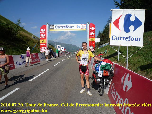
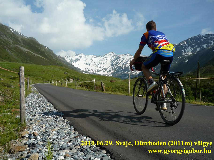
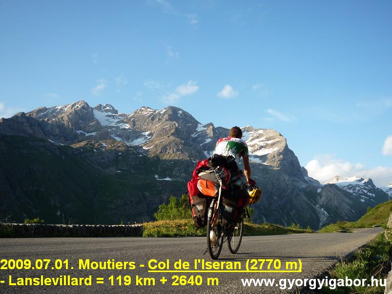
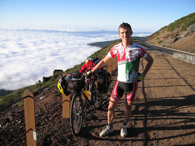
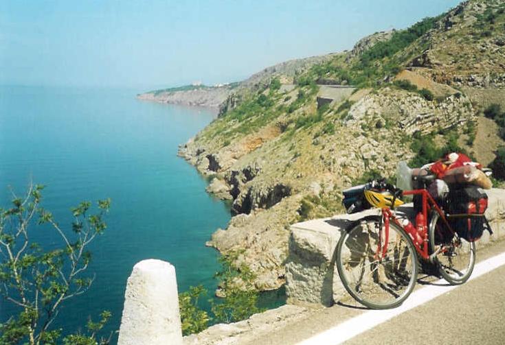
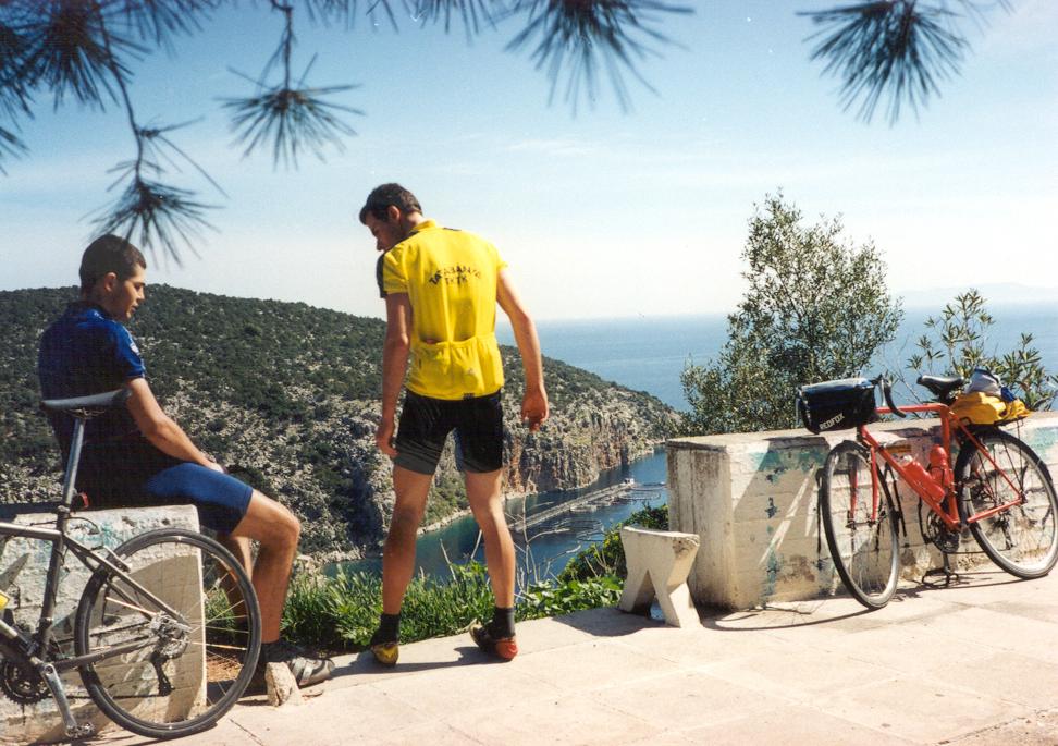
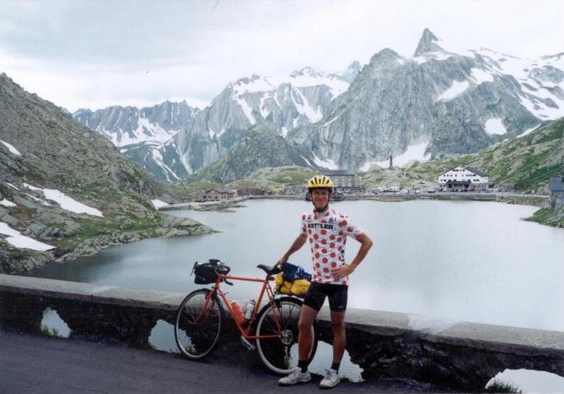
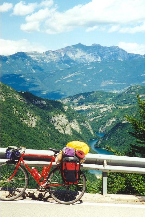
 My english site


 bringatúra / bicycle tour")
 bringatúra / bicycle tour")
 bringatúra / bicycle tour")
 bringatúra / bicycle tour")
 bringatúra / bicycle tour")
 felé - bringatúra / bicycle tour")

 - bringatúra / bicycle tour / fahrradtour")
 - bringatúra / bicycle tour / fahrradtour")
 - bringatúra / bicycle tour / fahrradtour")
 - bringatúra / bicycle tour / fahrradtour")
 - bringatúra / bicycle tour / fahrradtour")